Manufacturer of intelligent flight management systems, AeroScientific, has joined forces with camera manufacturer Hasselblad to create a new and exciting turnkey airborne imaging system for manned aerial mapping. The system is built around the recently-announced Hasselblad A6D 100 megapixel medium format aerial camera and offers some of the highest resolution imaging available for aerial surveying and mapping.
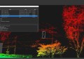
Adelaide-based AeroScientific has been developing flight management systems (FMS) for over five years. The Aviatrix FMS provides the functionality to control cameras in manned aircraft during missions: pilot navigation, camera triggering at predefined locations, and logging of all meta data. The Aviatrix FMS is currently used by both small and large operators in dozens of countries worldwide.
The Hasselblad A6D aerial camera features a 100 megapixel sensor and is available in both RGB and NIR models. Fast shutter speeds, a wide range of lenses, and a robust design make it the camera of choice for aerial applications. In combining these two innovative technologies, Hasselblad and AeroScientific aim to open up new possibilities in aerial surveying and mapping.
“Partnering with Hasselblad has given us a unique opportunity to create a brand new, fully integrated airborne mapping system” says AeroScientific CEO, Dr. Paul Dare. “The new A6D 100 megapixel medium format aerial camera is an excellent sensor which integrates seamlessly with our Aviatrix flight management system.”
In support of the new Hasselblad camera, AeroScientific has modified its software and upgraded its hardware. The company has designed and built, from the ground up, an airborne flight computer (the “FlightCube”) to ensure easy and efficient operations. Flight tests with the A6D and the FlightCube have shown that the new system performs exactly as expected.
“As a pilot myself, I know the importance of having a reliable system that is easy to use in the air” continues Dr Dare.
“This new system that we have developed with Hasselblad is exactly what every pilot wants: it makes mapping operations a quick and easy.”