A project to map and monitor native vegetation across Western Australia has been recognised with an award.
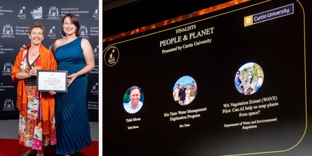
The WA Vegetation Extent (WAVE) Pilot has been recognised with a Merit Award in the People and Planet Solution of the Year category at the 35th Annual WAITTA INCITE Awards.
A project of the Western Australia Department of Water and Environmental Regulation (DWER), the WAVE Pilot is a flagship artificial intelligence initiative under the WA Government’s Native Vegetation Policy.
Led by DWER in partnership with seven other government organisations, the project has studied how satellite imagery, AI and cloud computing can be used to map and monitor native vegetation across Western Australia at an unprecedented scale.
Machine learning for native vegetation mapping
Accurate vegetation extent information is foundational to environmental management, land-use planning, conservation, biodiversity protection, climate resilience and regulatory decision-making.
But Western Australia’s vast size — 2.5 million square kilometres — and ecological diversity have historically made vegetation mapping difficult, time-consuming and expensive.
The WAVE Pilot has tested whether emerging technologies can help bridge this gap and provide more frequent, transparent and consistent information to support better decision-making.
This involved training machine-learning and pattern recognition systems to analyse satellite imagery in order to recognise where native vegetation is, where it isn’t and how that changes over time.
The aim has been to see if the technology has reached the level of maturity needed for it to be deployed as accurate, automated tools.
According to DWER, “Even if full automation isn’t possible, the pilot will still give us valuable insights. It will help us understand current limitations, build WA’s technical capability and guide how we improve vegetation mapping in the future.”
Partnering for vegetation mapping
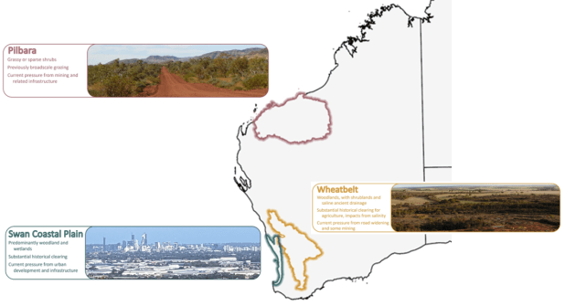
The WAVE Pilot has focused on three regions — the Pilbara, the Swan coastal plain and the southern Avon wheatbelt — based on the types of land use present, their biodiversity, pressures on the local native vegetation and the vegetation’s spectral appearance in the satellite imagery.
Interim updates to existing native vegetation maps are available for Perth and the Peel region, with wheatbelt mapping underway.
Led by DWER, the project’s partners are:
- Department of Planning, Lands and Heritage
- Department of Biodiversity, Conservation and Attractions
- Department of Primary Industry and Regional Development
- Department of Mines, Petroleum and Exploration
- Department of Fire and Emergency Services
- Landgate
- Environmental Protection Authority
There has also been engagement with scientific, academic and industry research partners, and technical experts.
Related reading:
NSW Native Vegetation Regulatory map to take effect
Mapping helps show Australia’s vegetation future
Vegetation map to benefit landowners, koalas