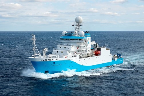
CSIRO’s research vessel RV Investigator to map the seabed along Australia’s eastern coast.
A team of Australian researchers, working with experts from the CSIRO, Geoscience Australia and James Cook University (JCU), will update an important area of seabed mapping along Australia’s east coast during an upcoming seven-day transit voyage of the CSIRO’s research vessel (RV) Investigator from Hobart to Brisbane.
According to Geoscience Australia, only 38.8% of Australia’s maritime territory has been mapped in sufficient detail for effective ocean management, and even in mapped areas there are gaps that need filling.
RV Investigator will depart on 16 July to retrace the path of United States research vessel RV Maurice Ewing, which mapped this particular strip of seabed during a 2002 voyage from Hobart to Guam.
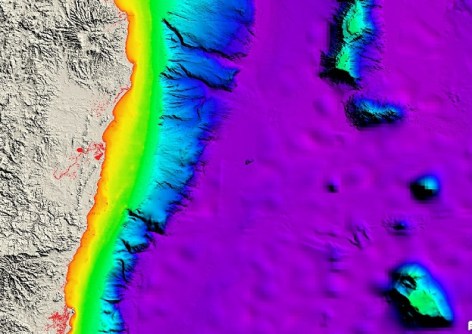
The RV Maurice Ewing used an Atlas HydroSweep DS system that generated a wide strip of poorly resolved seafloor with unresolvable vessel motion artefacts in depths around 4,000 metres in the Tasman Sea basin, an area frequently travelled by shipping.
The strip is highly visible in Geoscience Australia’s current national Australian Bathymetry and Topography (AusBathyTopo) grid and will affect planned regional AusBathyTopo grids in the region if the data cannot be replaced.
Higher-resolution is the aim
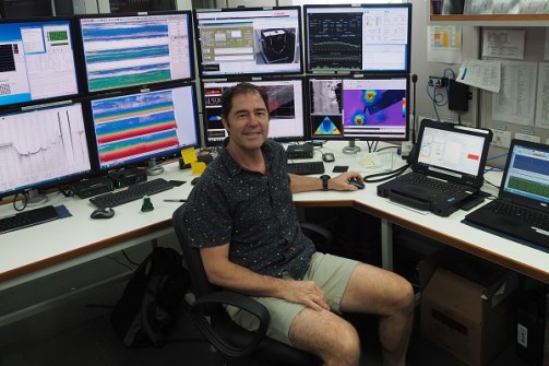
Aboard the RV Investigator will be a JCU marine geologist, Dr Robin Beaman, who will serve as Chief Scientist. Dr Beaman was recently appointed a Member of the Order of Australia for his work mapping the Great Barrier Reef.
“At the moment we have only low-quality seabed data in the area,” he said.
“But with RV Investigator’s advanced deep-water multibeam echosounders in play we will be able to see seafloor features to about 30 metres in scale.
“So we’ll certainly get submarine canyon details and any underwater landslides, or extinct underwater volcanoes that may be down there.”
The seabed mapping data to be gathered during the voyage will also contribute to the national Resourcing Australia’s Prosperity initiative being led by Geoscience Australia.
The data will be used to update the AusBathyTopo dataset, in particular the annually released national 250-metre bathymetry grid.
It will also be incorporated into the international General Bathymetric Chart of the Oceans.
Improving our understanding of the natural world
Also aboard will be JCU Masters research student, Katherine Wang, who says the seabed mapping is being done for more than just scientific curiosity.
“It provides important information for safe navigation, marine planning, environmental management and scientific research. It’s also used to identify hazards, support fisheries management, assess tsunami and coastal risks and guide offshore energy and infrastructure development,” said Wang.
Wang’s particular area of interest is the development and use of technology to help scientists collect accurate, large-scale information about Earth’s surface.
“The information we can collect through satellites, drones and sensors adds to and improves our understanding of the natural world, especially landscapes and environments that are difficult, dangerous or impossible to access directly,” she said.
“Geoscience technology allows us to monitor environmental changes and map landscapes. The accurate data and large area covered supports scientific research that seeks to improve the way we manage natural resources, respond to natural disasters, preserve the environment and plan infrastructure.”