

Image courtesy NASA
The US Space Force’s latest GPS III satellite has been launched and is now using its apogee kick motor to ascend to its final orbit 20,200 kilometres above the Earth.
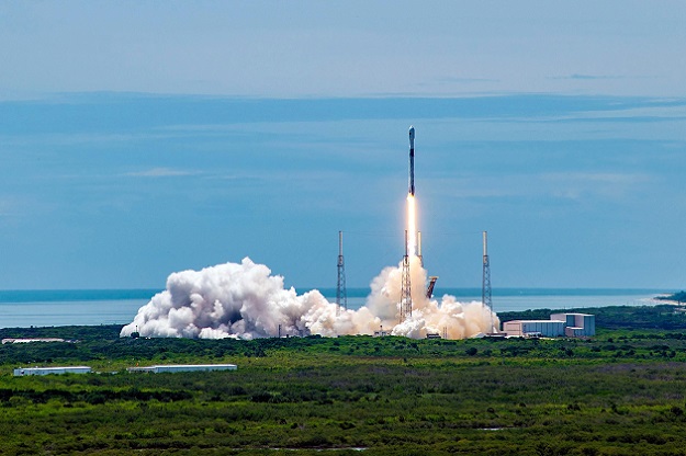
The Lockheed-Martin-built GPS III Space Vehicle 05 (GPS III SV05) was launched on June 17 from Cape Canaveral Space Force Station, Florida, aboard a SpaceX Falcon 9 launch vehicle. The satellite separated from the rocket about 90 minutes later.
Once the satellite reaches its final orbit in the coming days, commands will be sent to enable it to deploy its solar arrays and antennae.
GPS III SV05 is the 24th Military Code (M-Code) signal-enabled GPS satellite to have reached orbit, completing the constellation’s baseline requirement.
Overall, the GPS III series should provide three times better accuracy and up to eight times better anti-jamming capabilities. The M-Code satellites in particular aim to provide a more-secure, harder-to-jam and -spoof GPS signal.
The GPS III series also features the new L1C civil signal, which is compatible with other GNSS systems such as Europe’s Galileo.
“With GPS III SV05, we continue our focus on rapidly fielding innovative capabilities for the Space Force’s Positioning, Navigation and Timing Mission,” said Tonya Ladwig, Lockheed Martin vice president for Navigation Systems.
“Our next three satellites, GPS III SV06, SV07 and SV08, are already complete and just waiting for a launch date.”
Stay up to date by getting stories like this delivered to your inbox.
Sign up to receive our free weekly Spatial Source newsletter.


