Image credit: English Heritage/Historic England/Bentley Systems
Handheld 3D mobile mapping innovators GeoSLAM are teaming up with Bentley Systems, in a move the two companies say will enable the simple and fast production of hybrid reality models in any environment.
The partnership connects the two companies’ technologies, combining the GeoSLAM ZEB-REVO mobile mapping system and ZEB-CAM, and the latest version of Bentley’s ContextCapture software.
According to the companies, this means that it is now possible to produce high resolution textured reality meshes of indoor scenes, complex infrastructure and other challenging environments faster than ever before.

The ZEB-REVO handheld scanner with the ZEB-CAM attached.
Mark Reid, VP of Product Management, GeoSLAM says the simplicity of the ZEB-REVO handheld mobile mapping system has already democratized laser scanning “The next stage for us is to further improve how our results can be both interpreted and consumed within typical engineering and GIS workflows – and our partnership with Bentley is the perfect vehicle for this.”
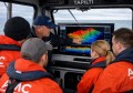
Bentley Systems’ reality modelling software, ContextCapture, available on desktop and mobile devices, produces engineering grade textured 3D models for design, construction, and operations derived purely from photographs. described as a quick and inexpensive way to provide real world context, the software is commonly used for modelling outdoor environments either from images taken from the ground or with the use of drones.
GeoSLAM was founded in 2012 as a joint venture between Australia’s national research body CSIRO and UK investors. CSIRO developed the revolutionary Zebeedee, which uses simultaneous localisation and mapping (SLAM) to accurately map indoors and outdoors in real-time.
GeoSLAM has since further evolved the systems to include the handheld ZEB1 and the newer ZEB-REVO handheld mapping systems, which are capable of recording 40,000 measurements every second.
Francois Valois, Bentley System’s senior director of software development, says his company is excited about extending what is possible with both ContextCapture and ZEB-REVO.
“With the recent introduction of hybrid processing, it is now possible to produce reality models based on both photos and laser data,” he says. “Certain environments such as indoors often prove to be a challenge for photogrammetry alone due to a lack of texture change. Hence, by using a hybrid solution it is now possible to generate accurate reality models of almost any environment.”