Newly released software has turned drones into enterprise-wide GIS productivity tools, enabling you to create orthomosaics, 3D meshes and more from your drone-captured still imagery, in minutes.
Drone2Map for ArcGIS, released last month by Esri, turns raw still imagery from drones into professional 2D and 3D imagery products. The desktop app means that affordable imagery is now available on demand for land analysis, infrastructure inspection, and monitoring events in times of natural disasters and environmental changes.
Dr Dipak Paudyal, Principal Consultant for Remote Sensing and Imagery for Esri Australia, said the surge in popularity of drones has the potential to revolutionise the way many industries operate.
“Aerial imagery is now cheaper and easier to capture, thanks to the rise of drone technology,” says Dr Paudyal.
“There has been huge growth worldwide in the use of Unmanned Aircraft Systems (UAS) and miniaturised inexpensive sensor evolution. At the same time, the technology to extract information from UAV and airborne digital imagery is rapidly evolving.
“The release of new products, such as Esri’s Drone2Map for ArcGIS and Harris’ OneButton, enable users to easily and automatically create GIS-ready fully georeferenced products in 2D and 3D.”
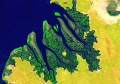
Imagery products that can be created with drone-based technologies include orthomosaics, digital surface models, and 3D point clouds and meshes.
For example, the Drone2Map for ArcGIS app cleverly detects camera and sensor parameters from the image metadata and then intelligently applies appropriate defaults.
In the field, Drone2Map for ArcGIS offers rapid imagery processing, so users can make sure they’ve captured everything they need right away, avoiding costly return trips. The imagery can be used immediately in ArcGIS to provide a clear, accurate picture of any asset or area for mapping, analysis, and decision making.
Drone technology is expected to have far-reaching implications across multiple industries by driving unprecedented efficiencies.
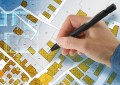
For example, for land analysis, drones provide an affordable means of capturing images of natural and man-made land-based features and areas that may be difficult to access or fully cover because of size or terrain.
In terms of infrastructure inspection, using drones improves the ability to inspect fixed assets, including those that span vast areas.
And in day-to-day monitoring, drones are perfectly suited for assessing scheduled events, environmental changes and the impact of natural disasters.