

Photo courtesy of the ABC.
The Surveying and Spatial Sciences Institute (SSSI) has announced that it will be hosting a National Bushfire Recovery Map-a-thon on 9th February in order to support Australia’s bushfire preparedness, mitigation, response and recovery efforts.
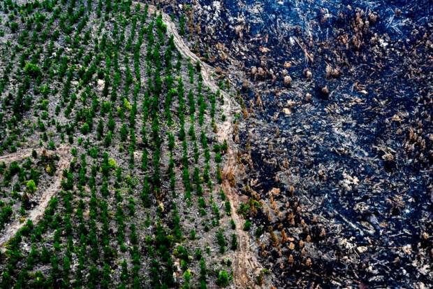
SSSI says in a statement that it is joining the rest of the global community in mourning the loss of lives, livelihoods and communities during the recent catastrophic bush fires. The SSSI acknowledges the extraordinary work undertaken by aid agencies, such as the Red Cross and WIRES and volunteer rural fires services working tirelessly to mitigate the destruction of these bush fires.
“We cannot replace all that has been lost. As a community we must rebuild together,” said SSSI president Dr Zaffar Sadiq Mohamed-Ghouse
The announcement says the SSSI has welcomed the announcement of the Morrison Government’s National Bushfire Recovery Agency that will coordinate a national response and help rebuild communities, and acknowledged the crucial work of other established foundations such as Minderoo that are dedicating significant funds and resources to bushfire response, recovery and resilience.
The professional body says it will support the Bushfire Recovery Agency and other recovery bodies in bringing its members and the wider community together to engage in mapping activities that will help governments, volunteer groups and charitable organisations deliver services where they are urgently needed.
“These fires have unified the global community. As we look towards recovery, the spatial science and surveying community has a vital role to play,” said Dr Mohamed-Ghouse.
On Sunday 9th February, SSSI will be hosting a SSSI National Bushfire Recovery Map-a-thon. Together with its members, the organisation is inviting the community to join in to collect data on areas most affected by the bushfires. The event is designed to provide recovery agencies accurate information to support the nation’s bushfire preparedness, mitigation, response and recovery efforts.
“The SSSI and our extended network will liaise directly with relevant aid and recovery agencies to ensure we collect the exact data needed to support the recovery process,” said Dr Mohamed-Ghouse.
“As we are only at the beginning of the fire season, our thoughts and hearts go to all those who have experienced devastation and who continue to fight these threatening fires. The SSSI National Bushfire Recovery Map-a-thon is a way the surveying and spatial science profession can work with the rest of the community to provide valuable input and assistance.”
How can I participate?
You are able to participate in the Map-a-thon in three ways (and from anywhere in the world):
• Individually – from the comfort of your own home/office or any preferred location
• As a team – form a team with family, friends and colleagues and map from the comfort of your own home/office or preferred location
• In person at one of our seven locations (Adelaide, Melbourne, Sydney, Perth, Canberra, Brisbane, Hobart) around Australia (please check ticket info prior to selecting this option)
If you are interested in participating in the SSSI National Bushfire Recovery Map-a-thon, just click the link or register your interest by emailing info@sssi.org.au.


