

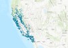
A new layer in the ArcGIS Living Atlas of the World links to the feed from more than 1,150 wildfire cameras.
Search results for "esri"

Emlid joins Esri’s global Partner Network
The move will enable Esri ArcGIS users to take advantage of Emlid’s GNSS equipment ecosystem.

Trimble and Esri renew strategic partnership
The companies aim to enhance their collaboration in GIS software, location intelligence and mapping.
Esri updates map with latest Sentinel-2 data
Annual 10m high-resolution maps are now available in Esri’s Living Atlas of the World for 2017–23.

Esri, NGS launch updated version of MapMaker
The interactive online mapping tool lets students and teachers explore the world through geography.

Esri to provide Malta agencies with GIS solutions
The three-year agreement includes Esri software, professional services and technical support.

Esri signs Earth science data agreement with NASA
More NASA-published Earth science data will be made available via Esri’s ArcGIS Living Atlas of the World.
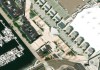
Esri’s Living Atlas gets better Maxar imagery
Esri will enhance its ArcGIS Living Atlas World Imagery layer with higher-resolution Maxar Vivid basemaps.

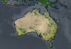
ANZ winners recognised in Esri annual awards
Australian and New Zealand entities have received ‘Special Achievement in GIS’ awards at Esri’s annual conference.
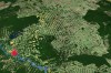
Esri releases 2020 global land cover map
The map, part of Esri’s Living Atlas, was built with Sentinel-2 imagery and a machine learning workflow.