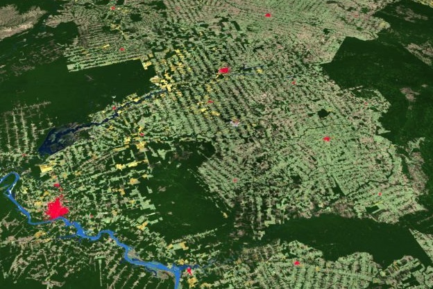
Image courtesy Esri
Esri has released a new high-resolution, 2020 global land cover map as part of its Living Atlas, built with Sentinel-2 satellite imagery and developed using a machine learning workflow developed by Impact Observatory and Microsoft.
Users will be able to use the map in association with other GIS layers such as terrain and hydrology, available in the ArcGIS Living Atlas of the World.
Impact Observatory was contracted to develop a deep learning, AI, land classification model using a training dataset of billions of human-labelled image pixels. The company then applied this model to the Sentinel-2 2020 scene collection, processing more than 400,000 Earth observations to produce the map.
The machine learning approach used will soon be made available on demand, and will be of interest to land managers who need to monitor for annual changes and seasonal differences.
The map will be updated annually to support change detection and highlight land changes, especially those related to human activity.
Esri is releasing the map under a Creative Commons license to encourage broad adoption. It will be made available in ArcGIS Online as a map service and will be freely available for use. It will also be available for downloading and viewing.
Stay up to date by getting stories like this delivered to your inbox.
Sign up to receive our free weekly Spatial Source newsletter.