

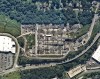
Initial offering will include vertical imagery updated multiple times per year at up to 5.5 cm resolution.
Search results for "asset management"
Vendor focus: Anditi
In the lead up to Locate22 in May, we’re highlighting some of the vendors you’ll be able to meet.

NZ Spatial Excellence Awards winners announced
Individuals and organisations have been recognised within NZ’s surveying and spatial fields.

Interview: Tom Celinski, Nearmap
In our Leaders Forum, we asked the experts to look ahead into 2022. Today we talk imaging with Tom Celinski.

Delving into digital doppelgangers
We speak with three industry experts to get a view into the past, present and future of digital twins.

12d Tech Forum 2021 | Online Industry Summit
Hosted by 12d – the companies behind 12d Model and 12d Synergy – the highly anticipated 12d Tech Forum returns on 19 – 21 October 2021. The three-day online industry summit will connect over 2,000 surveying, engineering, and construction professionals to learn, innovate, and be inspired. The 12d Tech Forum provides surveying and geospatial professionals […]
Read full story • Comments are closed

ANZ winners recognised in Esri annual awards
Australian and New Zealand entities have received ‘Special Achievement in GIS’ awards at Esri’s annual conference.
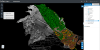
ScanX automates surveyors’ 3D point cloud data
Software start-up ScanX offers a new cloud-based platform to upload and automate surveyors’ 3D point cloud data using artificial intelligenc

Anditi’s road tech boosted by federal grant
The funding will help commercialise an AI product that extracts features from spatial data for road safety assessment.
ScanX automates surveyors’ 3D point cloud data
ScanX Cloud eliminates the time consuming task of manual processing and offers unrivalled accuracy and flexibility of the cloud.
Read full story • Comments are closed