

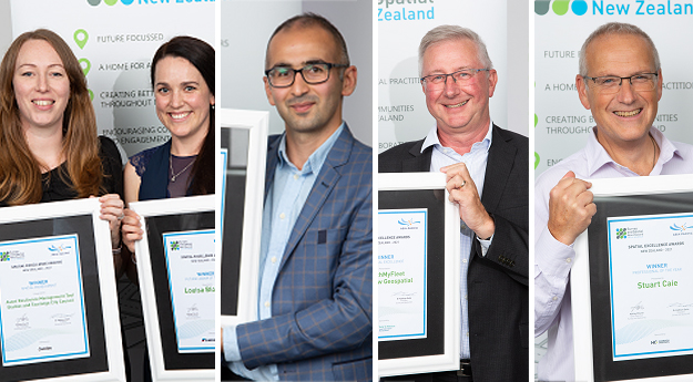
The winners of the 2021 Spatial Excellence Awards, hosted by Asia Pacific Spatial Excellence Awards (APSEA) and delivered by Survey + Spatial New Zealand (S+SNZ), were announced at a cocktail function held in Wellington 10 February.
The awards covered several categories across the surveying and spatial fields and were awarded to both individuals and organisations or collaborations.
The winners in the individual categories and their citations are as follows:
Postgraduate Student Award — Sponsored by NZ ESRI Users Group
Awarded to: Omid Khazaeian
As a PhD researcher in GIS, Khazaeian wanted to share their experience of unleashing the potential of survey and spatial data for a deeper insight in spatial mobility by taking a multidisciplinary approach and using models from outside spatial research. Their research introduces a spatial econometrics approach and how this approach helps leveraging data from the New Zealand Household Travel Survey and many existing spatial datasets for a profound understanding of urban transportation. As empirical evidence for transportation planning and policy, the research has been used by Wellington City Council for the proposed district plan’s transport chapter review.
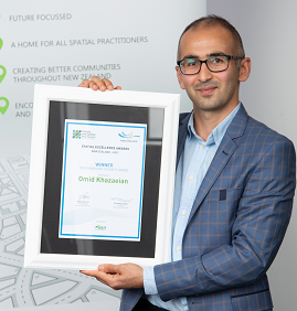
Omid Khazaeian
Professional of the Year Award — Sponsored by Harrison Grierson
Awarded to: Stuart Caie.
After 16 years working as a hydrographic surveyor in the UK, Caie joined the New Zealand Hydrographic Authority within Toitū Te Whenua Land Information New Zealand in May 2006. Since then, they have demonstrated strong technical expertise and leadership and become a well-respected and committed survey professional within both the national and international hydrographic community. As Manager Hydrographic Surveys, Caie is responsible for managing New Zealand’s multi-million-dollar hydrographic survey programme. Their leadership in the international context is demonstrated by the successful delivery of a multi-year international project to improve navigation and hydrographic capability in the Pacific Region.
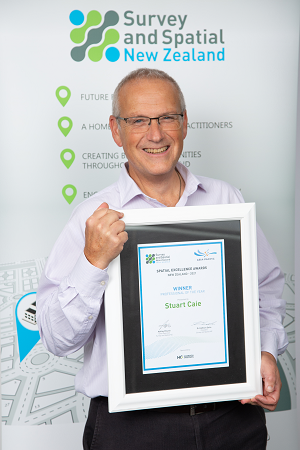
Stuart Caie
Leader of the Year Award — Sponsored by Synergy Positioning
Awarded to: Claire Buxton and Louisa Bloomer
There were two recipients in this category.
Buxton has an extraordinary passion for, and dedication to, the surveying and spatial Industry. Hours of her personal time is spent on creating opportunities for other young professionals to grow, lead and contribute their skills to a greater cause. Her leadership is recognised internationally in her role as the FIG Young Surveyors–Volunteer Community Surveyor Program Team Lead. She was instrumental in building a global team and scaling the program, overcoming challenges of a global pandemic and deploying young surveyors from around the world to areas of need.
Bloomer provides inspiring leadership as Stantec’s Asia Pacific Digital Practice Leader, on the Women in Spatial Committee, as a mentor, and on significant projects across New Zealand, Australia and the UK. She leads a team of 24 data, GIS and innovation staff to deliver significant industry projects; provides strategic direction and leadership for a community of 225; and drives innovation and new ways of working across Stantec globally by supporting incubation of new ideas, and as an innovation coach and mentor. She also grows spatial and data practice organisation-wide as the founder and chair of Stantec’s ANZ Digital Governance Board.
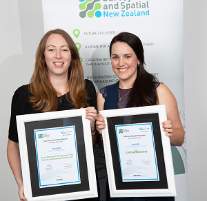
Charlotte Dawson (accepting on behalf of Claire Buxton) and Louisa Bloomer
The winners in the industry categories and their citations are as follows:
Award for Community Impact — Sponsored by Stantec
This award recognises unique contributions the spatial industry has had on people and communities.
Awarded to: Ngā Poutama Matahwenua l Practical Maori GIS Mapping Wānaga – Toitū Te Whenua Land Information New Zealand, Journey GIS Ltd and Te Kahui Manu Kahui Manu Hōkai, the Māori GIS Association
This was a collaboration between Toitū Te Whenua Land Information New Zealand (LINZ) and Te Kahui Manu Hōkai The Māori GIS Association, with support from Journey GIS Ltd, Ngā Poutama Matawhenua. The result is a programme of online mapping wānanga tailored for indigenous knowledge workers within iwi, hapū, Māori trusts and environmental groups. Geospatial information has the potential to transform the way land is viewed and understood. By showcasing the geospatial tools and resources available, Ngā Poutama Matawhenua empowers participants to practically apply what they learn to support a wide range of kaupapa related to whenua and tāiao.
Award for Environment and Sustainability — Sponsored by Harrison Grierson
The Environment and Sustainability award recognises products and projects that help to resolve an issue in an environmental context.
Awarded to: Ruru–Conservation Information System — Auckland Council and Geographic Business Solutions
Ruru–Conservation Information System was developed by Auckland Council to address the fragmented and siloed nature of conservation and environmental data across the organisation. The comprehensive spatial management system contains almost 80 datasets across a variety of disciplines, including native species management/restoration, pest plant/animal control, tree pathogen (kauri dieback) mitigation and community engagement. Automated spatial analysis and connectivity with external datasets provides more context and enables better operational decision-making to meet desired environmental outcomes. Centralised information ensures that high-level strategies (Auckland Plan, Indigenous Biodiversity Strategy, and Regional Pest Management Plan), and program level targets are being achieved and delivered effectively.
Award for Innovation, Medium-to-large Business — Sponsored by Eagle Technology
The Innovation Award recognises a unique delivery of a project, product or service based on a new idea, method, technology, process or application, resulting in significant social, environmental and/or economic benefits.
Awarded to: Asset Assessment Intervention Framework — Christchurch City Council
Asset Assessment Intervention Framework (AAIF) was developed to provide fast, auditable and repeatable renewal planning prioritisation for Christchurch City Council’s ‘three waters’ reticulation assets. Supporting the adoption of the New Zealand Asset Management Metadata standard, the AAIF uses complex spatial analysis to identify the investment required within the three waters portfolio. It has the potential to set a new benchmark in infrastructure asset management.
Award For Innovation, Small Business — Sponsored by Toitū Te Whenua Land Information New Zealand
The Innovation Award recognises a unique delivery of a project, product or service based on a new idea, method, technology, process or application resulting in significant social, environmental and/or economic benefits.
Awarded to: Tasman District River Surveys — Fox and Associates
Councils for years have relied upon sparse datasets comprising river cross sections up to 1km apart with little knowledge of what happens in between. This presents a problem for river management both for flood modelling and gravel management. Fox and Associates’ ability to integrate advanced technologies and develop new methodologies convinced the Tasman District Council to engage the company to fully 3D map 29 km of rivers encompassing 9 square km.
Award for Spatial Enablement — Sponsored by Jacobs
The Award for Spatial Enablement recognises products or projects in which the application of spatial information, methodology and/or tools has greatly improved the outcomes of a non-spatial project, process or product.
Awarded to: Asset Resilience Management Tool — Stantec and Tauranga City Council
Knowing where to invest is critical for resiliency. Cities want to be diligent and avoid investing in assets that may not be worth the investment long-term. Tauranga City Council has figured this out and Stantec helped them do it responsibly and efficiently.
Award for Technical Excellence — Sponsored by Toitū Te Whenua Land Information New Zealand
The Technical Excellence Award recognises surveying and spatial projects that apply existing technology and methodologies to an exceptionally high technical standard, overcoming significant technical challenges, and delivering outstanding results for the client.
Awarded to: SwitchMyFleet — Critchlow Geospatial
SwitchMyFleet is a free online evaluation tool for businesses considering switching their commercial vehicle fleet to electric power. Using authoritative NZ road network data from NationalMap and the user’s own real-world fleet configuration and route inputs, SwitchMyFleet calculates the metrics businesses need to build their case to transition.
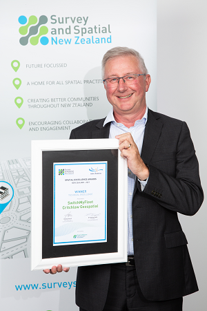
Steve Critchlow
Stay up to date by getting stories like this delivered to your inbox.
Sign up to receive our free weekly Spatial Source newsletter.


