

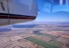
Airborne hyperspectral imaging could prove superior for identifying the kinds of trees that koalas prefer to eat.
Search results for "NASA"

Spatial Snippets for Wednesday, 14 January
This week: Lots of geospatial jobs, a geodesy webinar, NASA remote sensing training and more.
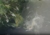
AI plus satellite data equals oil spill detection
Using AI to fuse satellite SAR and hyperspectral imaging could lead to faster mitigation of oceanic oil spills.

Sentinel-6B satellite set to survey sea levels
Sentinel-6B is equipped with an improved dual-frequency radar altimeter and microwave radiometer.

Twin HydroGNSS satellites poised for launch
The satellites will use reflected GNSS signals to monitor Earth’s land- and ice-covered surfaces and oceans.
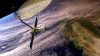
NISAR’s science phase to begin this month
Early images have revealed the dual-band, NASA-ISRO synthetic aperture radar satellite’s imaging strengths.

Spatial Snippets for Wednesday, 22 October
Enjoy our weekly compilation of general geospatial news snippets from across Australia and around the world.

Satellite data shows NZ’s major cities are sinking
New satellite data shows NZ’s major cities are sinking, mean rising sea levels will affect them sooner.

Australian Earth observations leader receives award
Australian Stuart Minchin has received a lifetime achievement award at the 2025 GEO Awards in Rome.

High school students to get a taste of real research
Students will be offered internships with the IGNIS project, which is mapping heat and lightning across WA.