

Four international teams will leverage AI and high-resolution data to build a first-of-its-kind ‘global water ledger’.
Search results for "NASA"

Workshop on AI Foundation Model for Earth Observation
When:
19 May, 2026 @ 9:00 am – 22 May, 2026 @ 5:00 pm
Where:
Huntsville, Alabama, and livestreamed
Join experts from artificial intelligence (AI) and data science, thematic applications, engineers and research scientists active in the field of foundation models (FMs) applied to climate, weather, Earth observation (EO), and Earth sciences from across[…]
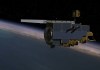
Ups and downs for fire spotting from space
As NASA’s Terra satellite begins to reach end-of-life, new fire-spotting software will be tested in orbit.

Australian scientists are close to the EDGE
NASA’s proposed Earth Dynamics Geodetic Explorer (EDGE) satellite mission features Australian involvement.
Vanuatu institutes natural disaster data system
The platform uses satellite and civil administration data plus open-source tools to forecast the impact of disasters.

UQ scholar’s career dream coming true
The grandson of an Australian space pioneer aims to improve data processing aboard Earth observation satellites.

Second-last GPS III-series satellite reaches orbit
GPS III satellite SV09 rocketed into space on Wednesday aboard a SpaceX Falcon 9 launch vehicle.
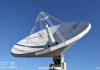
Explaining the importance of VLBI for geodesy
A new website outlines the importance of very long-baseline interferometry for geodesy and the wider community.
Spatial Snippets for Wednesday, 14 January
This week: More geospatial jobs, a chance to win an iPad Air, the small satellite market and more.

California’s new statewide LiDAR vegetation data
The entire state now has complete 10m and 30m coverage, with 1m data available in selected areas.