


Companies interested in becoming involved in multi-GNSS projects should register for a workshop that will take place in Melbourne later this month called ‘Multi-GNSS Asia’ (MGA). Multi-GNSS is the practice of using more than one GNSS network to gain a satellite location signal. Russian and European GNSS systems are on the horizon, while Japan […]
Search results for "GNSS"
The second Asia Oceania Regional Workshop on GNSS
Open to all international organisations, government agencies, industries, universities and research institutes which have an interest in GNSS utilisation in the Asia Oceania Region WHEN: 2010-11-21 to 2010-11-22WHERE: Royal Melbourne Institute of TechnologySTATE: VICCOUNTRY: AUS The workshop is open to all international organisations, government agencies, industries, universities and research institutes which have an interest in […]

Skoda uses GNSS in car testing
Czech auto maker Skoda is using GNSS receivers to measure the movements of its new models on test manoeuvres at the company’s development facility. As a test driver executes a sequence of close loops at high acceleration and speed, two on-board receivers receive and transmit continuous observations of the dynamic transverse movement of the vehicle. […]

World’s first hand-held GNSS integrated rover system – GRS-1. (Video)
Topcon Positioning System's (TPS) new GRS-1 is the world's first fully integrated dual-constellation, network-enabled RTK rover system. It is an all-in-one handheld GNSS receiver and field controller with high-speed processor, increased memory, built-in camera, compass and bar code reading function. Features also integrated into the new system are an SD memory card slot, optional internal […]
Air Traffic Control Moves to GNSS
About ten years ago it became clear that in many parts of the world airspace was approaching saturation point. Air transportation was plagued by delays, and safety had begun to be compromised. The existing outmoded groundbased radar systems, already stretched to the limit, were hardly able to cope. In the US, there are around 50,000 […]
The Future of GNSS
WILLIAM GIBBS At least one possible future for the delivery of high-accuracy services from global navigation satellite systems is becoming clearer as time passes. A large number of networks will be available. They will be operated by private enterprise. Surveyors and others in need of centimetre-level positioning have much to look forward to, although it […]
Latest two Galileo satellites join the fleet
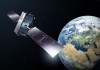
Following their launch in December, Galileo satellites 33 and 34 have been commissioned into service.

SouthPAN strengthens maritime positioning resilience
Port of Auckland is using RTK GNSS via LINZ PositioNZ-RT as the preferred correction for its Portable Pilot Units.

Bursary provides essential support for uni students
Three students presented their Honours projects this week, each of which was supported by a highly prized bursary.
Gold mining company’s LiDAR scan bears fruit
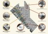
Clara Resources’ 39-square-km aerial LiDAR scanning campaign has identified seven potential exploration targets.

