

Jack Dangermond, founder of Esri, joins a wide array of first-class speakers lined up for the Locate22 conference.
Search results for "BIM"

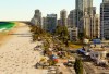
Smart Cities and 3D GeoInfo set for Sydney
The 7th Smart Data Smart Cities (SDSC) and the 17th 3D GeoInfo events will be held jointly in Sydney in October 2022.

Interview: Claire Rutkowski, Bentley Systems
In our new Leaders Forum, we ask experts to look ahead into 2022. Today we talk construction with Claire Rutkowski.
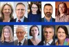
Key Locate22 conference speakers announced
Industry leaders from Australia and across the globe have been confirmed as speakers for the May 2022 events.

Interview: Martin Nix, Position Partners
In our new Leaders Forum, we ask experts to look ahead into 2022. Today we talk technology with Martin Nix.

Five drivers of change in geospatial information
New technology, industry structural shift and legislative change are some of the issues facing the sector.

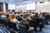
Locate22 conference registrations are now open
The preliminary program has now been released, with the first 100 registrants to receive a 10% discount.
Interview: Euclideon’s Daniel Zhang
High-speed 3D visualisation of geospatial data is opening up new possibilities across the industry.
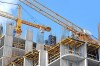
Trimble, Swinburne establish engineering tech lab
The Trimble Technology Lab will expand the university’s expertise in BIM, construction and mixed-reality.
SSSI NSW conference — call for abstracts
Industry members are invited to share projects, research and experiences at the SSSI NSW Regional Conference.