

Berrigan Shire Council has selected the Spatial Distillery Company to supply high-resolution satellite imagery via the Vantor Hub.
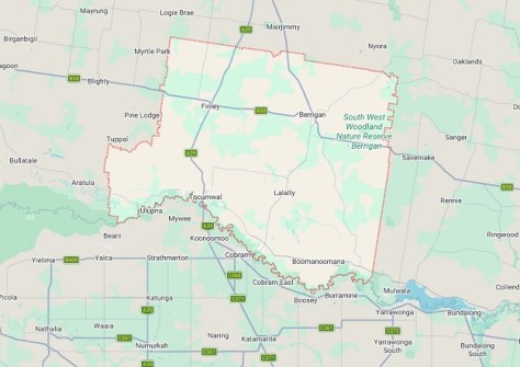
The Council is responsible for a little over 2,000 square kilometres of rural territory in the Riverina district of NSW, bordered on its southern side by the Murray River. Its major towns include Tocumwal and Finley.
Having access to the Vantor Hub will give the Council on-demand web access to regularly refreshed high-resolution satellite imagery covering the region’s urban, rural and agricultural environments.
Tahlia Fry, Director Corporate Services at Berrigan Shire Council, said the platform will deliver immediate operational value across multiple departments.
“Access to high-resolution, regularly updated satellite imagery through Vantor Hub provides our team with a practical and cost-effective way to monitor change across the Shire,” said Fry.
“It strengthens our internal decision-making, supports asset and infrastructure planning, and ensures we are working with current, reliable spatial information to better serve our community.”
The platform will enable the Council’s teams to visualise changes over time, assess infrastructure, monitor land use, and improve operational efficiency across departments.
“We’re proud to support Berrigan Shire Council with improved access to timely, high-quality satellite imagery,” said Nigel Lester, CEO The Spatial Distillery Company.
“Vantor Hub empowers councils with the visual intelligence they need to make faster, more confident decisions.”
Vantor was previously known as Maxar Intelligence, with the rebranding taking place in October last year.


