The Queensland Government’s Spatial Information branch has opened a survey to obtain industry feedback on its imagery and elevation products and future offerings.
Spatial Information is reviewing its imagery and elevation products and services to better understand how they are being used and where opportunities exist to enhance future offerings.
The review is in the form of a short survey that should take only about 10 minutes to complete.
The survey asks for input on the value of a range of existing and potential products, preferred data access methods, and priorities for future acquisitions and service improvements.
Spatial Information says the responses gathered will help inform future planning and the delivery of products that best meets customer and business needs.
The survey — which will remain open until 16 December 2026 — contains up to 20 questions, plus a text field for any additional comments.
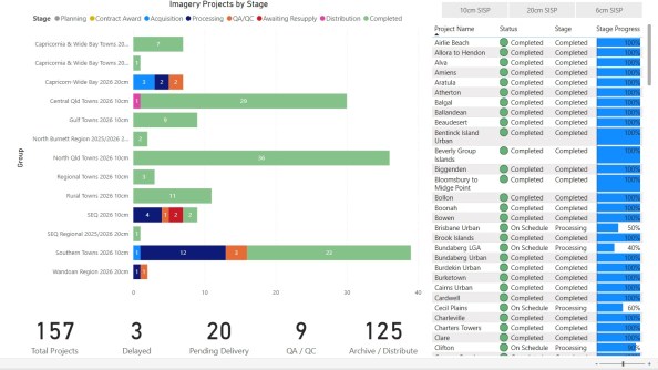
The status of the state’s elevation and imagery data collection projects can be viewed on the Live Project Dashboard.
Related reading:
DCS Spatial Services adds new elevation data
AI-powered elevation data to reduce flood premiums