Australian Made enterprise GIS platform Pozi is helping councils put spatial information in the hands of everyone who needs it, not just the GIS team.
PARTNER FEATURE
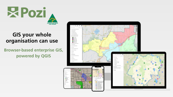
Pozi is a browser-based enterprise GIS platform powered by QGIS and developed and supported in Australia. More than 60 councils across the country use it to bring maps, spatial data and business information together in one place. That means planners, engineers, asset managers, field staff and executives can find and share trusted information without needing specialist GIS software.
This year Pozi received official Australian Made certification. The certification recognises a platform that is Australian owned, developed and supported, with customer data hosted onshore.
Pozi users will meet this month in Bendigo, Victoria, for an exclusive Pozi User Group meeting. Fittingly, it will be held on International GIS Day, 18 November.
To learn more about what Pozi does, how it’s evolving and what lies ahead, we spoke with Chris Scott, General Manager, Operations at Pozi.
For those who don’t know, what is Pozi? What role does it perform?
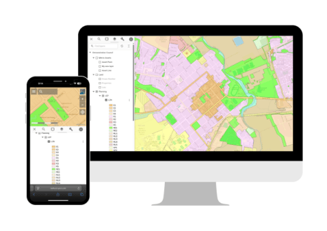
Pozi is a browser-based enterprise GIS that makes spatial information easy for everyone in an organisation to find and use. It brings maps, spatial data and business information together in one place, so a planner, an engineer or someone on the customer service desk can look up a property, check an asset or measure a site without installing specialist software.
Behind the scenes it’s powered by QGIS, so teams can keep working in the tools they know and publish to the rest of the organisation. Today Pozi is trusted by more than 60 councils across Australia and is increasingly being adopted by asset intensive and service-based organisations that depend on spatial data to manage operations, assets and customer outcomes.
How did it come about? When and where was it developed, and by whom?
Pozi began in 1999 as a GIS consultancy supporting Victorian councils and evolved into the Pozi software platform in 2019. More recently, MNG and Chartis Technology formed the Pozi joint venture. That brought new investment, a national reseller network and a development team based in Australia. Since then, the pace has picked up: new self-service tools like Site Manager, and Australian Made certification this year.
Describe a typical Pozi user and the kinds of ways in which they can apply it to their work.
There isn’t really one typical user, and that’s the point. Pozi is built for the people who need spatial information but don’t spend their day in GIS software. In a council that might be a planner checking zoning and overlays, an asset manager looking at road or drainage networks, customer service staff answering a ratepayer’s question about a property, or an executive looking at where capital works are going. GIS teams use it too, publishing maps from QGIS once so the whole organisation can explore, measure, mark-up and share them through a link.

What advantages does being built on QGIS bring?
QGIS is a widely used, open-source GIS backed by a large global community. Building on it means our customers’ GIS teams keep working in a tool they already know, often already use, and don’t pay licence fees for. What they build in QGIS is what everyone sees in Pozi, so there’s no rebuilding maps in a second system.
It also keeps organisations on an open foundation rather than a proprietary stack. We actively contribute to the open-source ecosystem as a QGIS Sustaining Member and by sponsoring key projects such as OpenLayers that underpin modern spatial technology.
Likewise, what advantages does being certified ‘Australian Made’ bring, e.g. sovereign risk, back-up support?
Pozi has always been designed, developed and supported here, and our Australian Made certification means that’s now independently verified rather than just something we say. For customers it matters in practical ways. Customer data is hosted in Australia, under Australian data sovereignty standards. The people accountable for the product are here. And when you need help, support comes from our Australian reseller partners, MNG and Chartis Technology, in your time zone rather than a ticket queue on the other side of the world. For councils weighing sovereign risk and continuity, that’s real peace of mind.
Does Pozi work as a standalone platform, or can it interconnect with other systems a user might already have?
Yes, Pozi works as a complete platform on its own. Staff can view, search and measure maps in a browser, mark them up and share a live map with a link, and authorised users can manage sites, layers and permissions through Site Manager.
Due to Pozi’s flexible architecture, its real value, though, comes from connecting what organisations already have. Pozi integrates with many existing business systems, so map layers can integrate and display information from property, asset and other corporate systems. With Metrix Assets, for example, councils see asset data alongside their other spatial layers, with a two-way link between the systems.
Is it an office-only system, or can it be used out in the field? And if so, how?
Pozi runs in a browser, so it works just as well on a tablet or phone as it does at a desk. Out on site, staff can open a map, see what’s around them, measure and mark up, and send a link straight back to the office. When they need to capture data, MerginMaps, hosted by Pozi, lets crews collect and update information on a mobile device, even without reception. It all flows back, via structured synchronisation process, into the same QGIS projects the GIS team manages, so there’s no re-keying or double handling, and everyone works from the same up-to-date information.
I understand you have an event coming up for GIS Day in November? Please tell us about that.
Yes, we’re marking GIS Day by bringing our users together for the Pozi User Group on Wednesday, 18 November in Bendigo. It’s an exclusive day for Pozi customers to meet the team behind the platform, share how they’re using Pozi, and swap ideas with peers from other councils and organisations. A lot of our best product thinking comes from conversations like these, so we’re looking forward to hearing what our users want next. It felt fitting to hold it on GIS Day, a day about the difference spatial information makes.
What’s coming up for Pozi in the year ahead? Any new features or developments? For instance, are you joining the trend for AI adoption?
Over the next year, we’re focused on making Pozi easier to manage, easier to integrate and easier to scale. That includes improving how GIS projects and configurations are managed, streamlining publishing workflows, and expanding integrations with the systems our customers already use. Ultimately, it’s about helping organisations get trusted spatial information into the hands of more people, with less effort and complexity.
Looking further ahead, we’re investing in cloud-enabled capabilities and exploring how a more flexible SaaS model can simplify deployment, administration and self-service. We’re also keeping a close eye on developments in AI and undertaking focused research to understand where it can genuinely improve the way people interact with spatial information. We’re interested in practical, customer-driven outcomes rather than adopting technology for technology’s sake, and we’ll continue to evaluate opportunities as the landscape evolves.
It must be gratifying to be part of such a long-term, homegrown success story?
It is, genuinely. Pozi started in 1999 as a small consultancy helping Victorian councils, and more than 25 years later it’s trusted by more than 60 councils across Australia. What I find most rewarding is that the original idea still holds: spatial information shouldn’t be locked away with a few specialists. Every time a planner or a field officer answers their own question with a map, that’s the idea working. Becoming Australian Made certified this year felt like a fitting milestone for something that’s been true all along.
Final question: What haven’t we asked? What else would you like to convey?
That Pozi isn’t only about the software. It’s delivered through our reseller partners, MNG and Chartis Technology, who know the organisations they work with and provide training and support locally. And it’s backed by an engaged user community that shares ideas and helps shape where the product goes. If you’re a council or organisation wondering whether enterprise GIS has to be complex or expensive, I’d encourage you to take a look. Insightful maps, informed decisions are what we’re here to help with.