Copyright: Phase One Industrial
Phase One Industrial and SimActive have teamed up to develop an integrated system for aerial photogrammetry projects. The collaboration sees SimActive’s photogrammetry software integrated with Phase One Industrial’s expertise in medium format aerial imagery and industrial digital photography equipment.
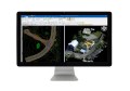
SimActive’s Correlator3D version 6.1 software can read and process both the GPS and IMU information directly from Phase One Industrial cameras’ image files as well as system information such as the sensor pixel size and lens focal length. The integrated system will allow users to take images directly from Phase One operations and import them into Correlator3D.
Correlator3D performs aerial triangulation and generates DSMs & DTMs and orthomosaics with no limit to the number of images. The software is supported by patented algorithms, GPU-enabled processing and technology for handling large mosaics. With the GPS/IMU data automatically extracted from the metadata, users avoid having to import the information separately and benefit from a simplified method of editing terrain models and mosaics.
For further information visit SimActive’s website.