

The ProFlex 500 CORS is Ashtech's new advanced, multifunctional Continuously Operating Reference Station Receiver. Ashtech has released a new advanced, multifunctional Continuously Operating Reference Station Receiver. The ProFlex 500 CORS is designed to collect, store and transmit high quality GNSS data for multiple applications, including a CORS and a field campaign receiver, for either post-processed […]
Hitchhiking Enters the Mobile Navigation Age
By Spatial Source on 7 June, 2010Car pooling in Germany has entered the internet age with OpenRide, a dynamic ride-share program being developed at the Fraunhofer Institute for Open Communication Systems in Berlin. This mobile browser-based application automates the process of finding a driver or passenger to share the cost of a journey. According to Jan Ziesling, financial planner for […]
LBS Revenues to Reach EUR 420 million in 2015
By Spatial Source on 7 June, 2010Mobile location-based service revenues in Europe are forecast to reach €420 million (AUS $606 million) in 2015, up from €220 million (AUS $317 million) last year, according to new report. The report from market research firm Berg Insight predicts that local search, navigation services and social networking will become the top applications for mobile […]
Trimble and Russian Space Systems Joint Venture
By Spatial Source on 7 June, 2010Trimble and the Russian Space Systems are teaming up on a satellite project. The Moscow-based joint venture, Rusnavgeoset, will sell commercial GNSS geodetic network infrastructure systems for Russia and the Commonwealth of Independent States. According to Trimble, operations will start once the venture has been registered, which is expected to occur this month.
Crowdsourcing For Real Time Traffic Reports
By Spatial Source on 7 June, 2010Australian drivers are encouraged to become real time traffic reporters through a user-based mobile navigation network. Waze uses crowdsourced road information to deliver live maps and real time traffic updates to commuters in cities around the world. The free iPhone, Android and Blackberry application allows users’ GPS-enabled phones to transmit live traffic reports. […]
New GPS Requirement for US Aviation
By Spatial Source on 7 June, 2010Aircraft will need to be equipped with new global positioning technology when operating in US airspace following new regulations from the US Federal Aviation Administration. The new equipment, which will enable a plane’s exact position to be broadcast to ground controllers and other planes in the sky, must be in place by 1 January […]
Online Atlas Unlocks Biodiversity Data
By Spatial Source on 7 June, 2010An online portal bringing together all existing data on Australia’s living species – including images, maps, literature, research, records and taxonomic information – is being launched in September. Atlas of Living Australia will provide free access to an estimated $1 billion worth of biodiversity resources, which are held in museum, research, university and government […]
GITA, 15th Geospatial Solutions Conference, AUS & NZ
By Spatial Source on 3 June, 201015th Annual Geospatial Solutions Conference, Brisbane WHEN: 2010-08-02 to 2010-08-04WHERE: Sofitel BrisbaneSTATE: QLDCOUNTRY: AUS Brisbane, QLD, 2-4 August, "Smarter Infrastructure for a Sustainable Future" www.gita.eventplanners.com.au
JURSE 2011
By Spatial Source on 1 June, 2010Joint Urban Remote Sensing Event (JURSE) WHEN: 2011-04-11 to 2011-04-13WHERE: Munich, GermanySTATE: InternationalCOUNTRY: INT This is the Joint Urban Remote Sensing Event (JURSE) of the 6th IEEE GRSS and ISPRS Joint Workshop on Remote Sensing and Data Fusion over Urban Areas, and the 8th International Symposium of Remote Sensing of Urban Areas. www.jurse2011.tum.de
Latest Geospatial News
View allCool Tools
View All-
 Responsible AI for better decisions: Why geospatial context matters
-
 Stop parking it: meeting the Essential Eight with ArcGIS may be more achievable than you think
-
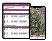 GBM Konect launches Konect 2 to close the field data gap
-
 Inside the 12d Tech Forum 2026: Automation, Collaboration, and the Industry’s Next Chapter
Events
View All-
Oct 30
Western Australia EISSI Awards 2026
 Pan Pacific, Perth
-
Nov 6
GIS in Local Government Day 2026
Amora Hotel Adelaide, 233 Victoria Square, Adelaide -
Nov 9
2026 Advancing Earth Observation Forum
Hobart, Tasmania -
Nov 10
SouthPAN Industry Day
Online -
Nov 13
South West and Great Southern Surveyors Conference
Mantra Bunbury Lighthouse, Bunbury, WA

