

 Car pooling in Germany has entered the internet age with OpenRide, a dynamic ride-share program being developed at the Fraunhofer Institute for Open Communication Systems in Berlin.
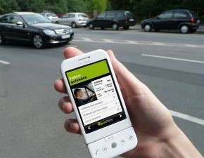
This mobile browser-based application automates the process of finding a driver or passenger to share the cost of a journey. According to Jan Ziesling, financial planner for OpenRide, users can find a match in about five seconds.
Users open the application and select whether they are offering or looking for a ride. They then enter their starting and finishing points and the number of places available or required. The application gets a fix on the user's position using GPS, WLAN or mobile phone information and sends all the information to the OpenRide server.
The search engine compares the offers and requests received. For drivers, it analyses the route they are likely to take and searches for potential passengers on the way. For passengers, it searches for drivers passing the passenger’s location on the way to their destination. Matching offers are displayed in real time with the message ‘Driver found’ or ‘Passenger found’, stating the name and the probable pickup and travel time.
Intelligent route matching sets OpenRide apart from other systems, which only match people with the same starting point and destination. The algorithms used in the OpenRide system are able to incorporate partial journeys, short detours and the current position of the driver and potential passenger.
“A good example is if a driver is driving a long distance but he is taking someone with him for a short part of that journey,” Ziesling said. “It is very difficult to find those matches if you do the matching process by yourself. But it's definitely possible if you do it automatically.”
The software also calculates a suggested rate for shared rides. This is based on the cost of car ownership, which can be adjusted by users depending on the type of car, fuel prices and circumstances, such as urban versus motorway driving.
Ziesling said future developments will include implementing the application in personal navigation devices and providing live information. The researchers are also planning to equip OpenRide with a rating system and user profiles to help build trust between drivers and passengers.
Visit the OpenRide website for more information.


