

Organisers of the Queensland Spatial Excellence Awards are calling for nominations to recognise excellence in the spatial sciences. The awards acknowledge those at the forefront of the spatial information industry in Queensland and provide an opportunity for spatial information projects and professionals to showcase their achievements. Winners at the Queensland awards are automatically nominated for […]
SKM 3D Laser Scanner
By Spatial Source on 15 June, 2010A new 3D mobile laser scanner will be available through SKM. The Riegl VMX-250 scanner can be used for mapping roadways, rail corridors and waterways as well as urban areas. The system, which can be mounted on the roof of a vehicle, produces detailed 3D point cloud data. The system can perform 600,000 time-of-flight measurements […]
Mapping the Oil Spill Disaster
By Spatial Source on 15 June, 2010A new animation provides a frightening glimpse of the Gulf of Mexico oil spill. Scientists at the National Centre for Atmospheric Research in the US have created a model, based on ocean currents in the area, which shows the likely path of the oil over a three-month period. The animation provides a graphic projection […]
CRCSI Workshops on Sustainable Development
By Spatial Source on 15 June, 2010The Co-operative Research Centre for Spatial Information (CRCSI) is hosting a series of urban development workshops from 17 to 24 June to help shape the organisation’s research activities. The events, which are open to the public, will focus on spatial tools for urban regeneration in regards to greyfield development. Greyfields – ageing, declining middle […]
GPS Restores Irrigation in Afghanistan
By Spatial Source on 15 June, 2010Project field officers in Afghanistan are using GPS to help restore the country’s irrigation infrastructure. GPS-equipped cameras provide a simple, inexpensive method of tackling a key challenge in the war-torn country: access to water. According to the World Bank, only 12 per cent of Afghanistan’s land is arable. Of that land, 85 per cent […]
EnergyAustralia Wins Smart Grid in NSW
By Spatial Source on 15 June, 2010EnergyAustralia has been selected to run the federal government's Smart Grid, Smart Cities project in New South Wales, which is due for completion in 2013. The utility will be rolled out the $100 million smart grid to five sites in Sydney and the Hunter. The 12,000 smart sensors across EnergyAustralia's electricity network will be […]
Virtual Polar Project Launched
By Spatial Source on 15 June, 2010An open access project to provide scientific polar data and information has been launched by a consortium of international science and research organisations. The Polar Information Commons is designed to provide a long term, open access framework for polar data. The resource will be managed by the polar science and data community. The project […]
New Trimble S3 total station
By Spatial Source on 15 June, 2010All you need to perform efficient surveying campaigns is included in the new Trimble S3 total station solution. The new Trimble S3 total station is an accurate and reliable surveying instrument that comes with an integrated robotic radio, the popular Trimble TSC2 data controller (or fixed control unit for Servo and Autolock versions) with your […]
Next-Gen GPS Satellite Launched
By Spatial Source on 15 June, 2010The US Air Force launched the first of a new fleet of advanced global positioning system (GPS) satellites on 28 May. The new satellite, GPS 2F-1, has twice the accuracy of previous navigation satellites and a stronger signal capacity. The solar-powered craft is designed for a 12-year mission and is the first of 12 satellites […]
Pictometry Online from AAM – Featuring the 2010 World Cup Stadiums
By Spatial Source on 10 June, 2010To celebrate the opening of the 2010 World Cup in South Africa, AAM have released a free World Cup Stadium Viewer on their website using Pictometry Online. The World Cup Stadium Viewer is quick and easy to use. Simply click onto one of the soccer balls to open up a Pictometry captured image of the […]
Latest Geospatial News
View allCool Tools
View All-
 Responsible AI for better decisions: Why geospatial context matters
-
 Stop parking it: meeting the Essential Eight with ArcGIS may be more achievable than you think
-
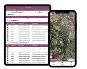 GBM Konect launches Konect 2 to close the field data gap
-
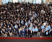 Inside the 12d Tech Forum 2026: Automation, Collaboration, and the Industry’s Next Chapter
Events
View All-
Oct 30
Western Australia EISSI Awards 2026
 Pan Pacific, Perth
-
Nov 6
GIS in Local Government Day 2026
Amora Hotel Adelaide, 233 Victoria Square, Adelaide -
Nov 9
2026 Advancing Earth Observation Forum
Hobart, Tasmania -
Nov 10
SouthPAN Industry Day
Online -
Nov 13
South West and Great Southern Surveyors Conference
Mantra Bunbury Lighthouse, Bunbury, WA

