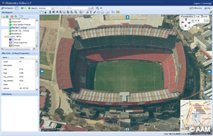
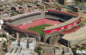
To celebrate the opening of the 2010 World Cup in South Africa, AAM have released a free World Cup Stadium Viewer on their website using Pictometry Online.
The World Cup Stadium Viewer is quick and easy to use. Simply click onto one of the soccer balls to open up a Pictometry captured image of the stadium, then click onto the stadium image to initiate an interactive view of the stadium. This allows you to easily experience AAM’s Pictometry browser with high quality views of each stadium from all perspectives: north, south, east, west and vertical.

Pictometry Online provides automatic and instant access to oblique and vertical views in an intuitive, easy-to-use web interface. Users have online access to measurement tools such as building height, roof pitch and area which is the unique differentiator of this product from anything else available.

AAM and partner company AOC Geomatics have also created fully rendered, very high resolution 3D models for the Soccer City, Ellis Park and Nelson Mandela Stadiums. Movies of these 3D building models showcase the different angles and views and are available at the AAM website. AAM and AOC are constantly updating their Pictometry Online coverage, with extensive coverage already available over Australia, South Africa and New Zealand.
Sign up for your free Pictometry Online trial or view the 3D building model videos online at www.aamgroup.com
Contact: Alex Cowdery
Phone: 02 8879 1600
Email: a.cowdery@aamgroup.com
Web: www.aamgroup.com


