

The new Foresight Report 2030 outlines factors that challenge every assumption about geospatial intelligence.
Team Australia takes the helm at CEOS
By jnally on 17 November, 2025The Committee on Earth Observation Satellites will be led in 2026 by CSIRO, GA and the Bureau of Meteorology.
Women in GIS awards and scholarships
By jnally on 13 November, 2025Three awards and six scholarships are on offer to women from any country who work in the field of GIS.
NSW invests another $20 million into Land iQ
By jnally on 13 November, 2025Land iQ uses more than 200 data sources and 75 land-use data types to help public- and private-sector land planning.
Twin HydroGNSS satellites poised for launch
By jnally on 12 November, 2025The satellites will use reflected GNSS signals to monitor Earth’s land- and ice-covered surfaces and oceans.
Latest Geospatial News
View all
The funding boost includes $75 million each from the National Reconstruction Fund and Hostplus.
 2026-01-22
ADVERTISEMENT
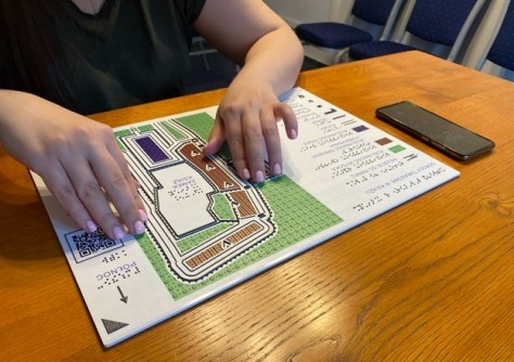
More than 30 international contributors have collaborated to produce a ground-breaking book on tactile mapping.
2026-01-22 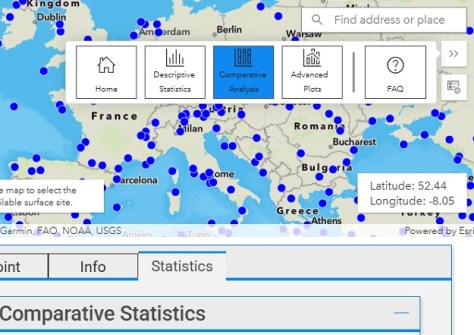
This week: More geospatial jobs, a chance to win an iPad Air, the small satellite market and more.
2026-01-21 
Hydrosat has raised $89m in Series B financing while SkyFi has raised $19 million in a Series A round.
2026-01-20 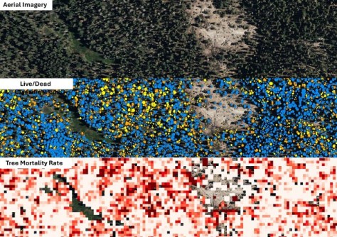
The entire state now has complete 10m and 30m coverage, with 1m data available in selected areas.
2026-01-20 
New Zealand is looking to modernise its 2009-era Standard to take account of new technologies and practices.
2026-01-20
ADVERTISEMENT
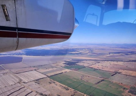
Airborne hyperspectral imaging could prove superior for identifying the kinds of trees that koalas prefer to eat.
2026-01-19 
- Sponsored Content
Aidedo was founded based on the practical experience of CEO Aiden Tong while studying and working with many Civil Engineering and Land Surveying firms in developed countries.
2026-06-02
The Earth observation spacecraft has been given new tasking to test its sensitive detectors during night passes.
2026-01-19 Cool Tools
View All-
 The finding that shows up in nearly every ArcGIS security review
-
 CHC Navigation at Locate26: Connected Geospatial Solutions Across Land, Air and Water
-
 Responsible AI for better decisions: Why geospatial context matters
-
 Stop parking it: meeting the Essential Eight with ArcGIS may be more achievable than you think
Events
View All-
Nov 6
GIS in Local Government Day 2026
 Amora Hotel Adelaide, 233 Victoria Square, Adelaide
-
Nov 9
2026 Advancing Earth Observation Forum
Hobart, Tasmania -
Nov 10
SouthPAN Industry Day
Online -
Nov 13
South West and Great Southern Surveyors Conference
Mantra Bunbury Lighthouse, Bunbury, WA -
Nov 24
Locate26 Conference / 10th Digital Earth Summit
Melbourne Convention & Exhibition Centre

