

Research reveals secrets of Queensland’s megafauna extinction.
Teledyne Optech launches LiDAR for corridors
By Spatial Source on 5 August, 2020Teledyne Optech claims the Galaxy CM2000 offers the smallest laser footprint currently on the market.
DOT’s solar logistics tracker features u-blox componentry
By Spatial Source on 5 August, 2020DOT Telematik chooses u-blox for GNSS and cellular duties in its new telematics tracker for rail and freight.
The ZEB Horizon: One tool, endless possibilities
By Spatial Source on 4 August, 2020We want to introduce you to the ZEB Horizon, GeoSLAM’s strongest ever SLAM.
Faro releases Focus Swift indoor scanner
By Spatial Source on 4 August, 2020Faro’s Focus Swift promises speedy and accurate indoor reality capture.
Children’s book to celebrate diversity in STEM
By Daniel Bishton on 4 August, 2020Book and AR app present female role models using geospatial tech in an engaging presentation for young learners.
Managing large photogrammetry projects with SimActive software
By Spatial Source on 4 August, 2020SimActive’s Correlator3D product is a high-end photogrammetry software providing full control over the production workflow.
The BIG GIS topics you need to know
By Spatial Source on 31 July, 2020Listen and subscribe to the GIS Directions podcast for a fun fix of short, sharp and immediately usable geospatial tips and insights. Join your hosts Wayne Lee-Archer, Ta Taneka and Josh Venman as they chat with inspiring GIS users, discuss new industry trends and dish out plenty of practical pointers. GPS vs. Blockchain Learn how geomining […]
Got solutions? Maxar Spatial Challenge open for entries
By Spatial Source on 29 July, 2020The new competition seeks industry professionals to put their skills to work to address key challenges in Australia.
Latest Geospatial News
View all
The in-person and online meeting will explore the theme of ‘mapping the future of land administration’.
 2021-08-04
ADVERTISEMENT
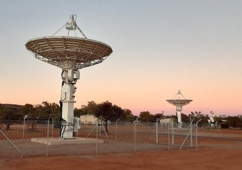
The Territory Space Strategy 2021–25 aims to position the Northern Territory as a world-class space locale.
2021-08-03 
The Australian company is aiming to expand its offerings in GPS, radio frequency systems, sensors and robotics.
2021-08-03 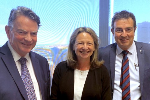
Harris has been elevated from Deputy to Chair of the peak government body responsible for spatial information.
2021-08-02 
The Hub will offer secure labs, clean rooms, rapid prototyping facilities as well as mentoring and training.
2021-08-02 
The poster encourages children to delve into surveying while learning the culture of our Traditional Owners.
2021-08-02
ADVERTISEMENT

The hybrid in-person and virtual event aims to attract more than 80 exhibitors and 2,500 industry professionals.
2021-07-28 
- Sponsored Content
Aidedo was founded based on the practical experience of CEO Aiden Tong while studying and working with many Civil Engineering and Land Surveying firms in developed countries.
2026-06-02
Brisbane’s new underground Cross River Rail is setting new benchmarks for the federation of BIM, GIS and 3D.
2021-07-28 



Events
View All-
Nov 9
2026 Advancing Earth Observation Forum
 Hobart, Tasmania
-
Nov 10
SouthPAN Industry Day
Online -
Nov 13
South West and Great Southern Surveyors Conference
Mantra Bunbury Lighthouse, Bunbury, WA -
Nov 24
Locate26 Conference / 10th Digital Earth Summit
Melbourne Convention & Exhibition Centre -
Nov 30

