Open access to Tasmania’s historic aerial imagery

By on 28 September, 2022

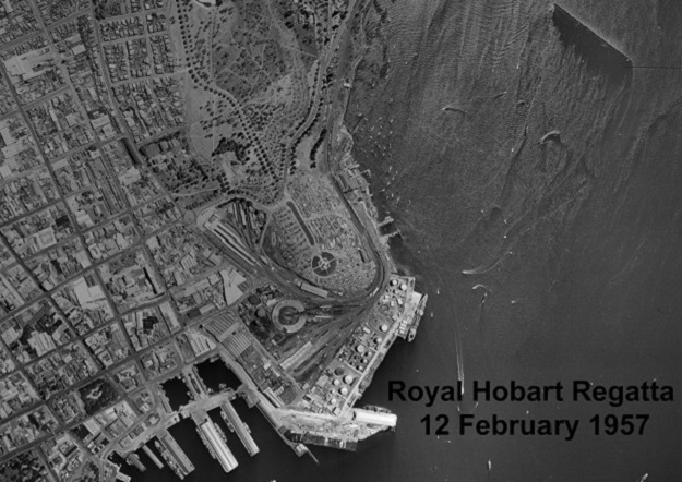
Historic aerial image showing the 1957 Royal Hobart Regatta. Courtesy Land Tasmania.

Land Tasmania has released a new version of its Aerial Photo Viewer (APV), which enables people to search, view and download free of charge, images from the extensive aerial record of Tasmania managed by the agency.

The images span the period from 1945 to the present, and both historic and newly captured imagery is continually being added.

Land Tasmania says the new APV is aimed at meeting an increasing demand for access to its historical imagery library.

The web-based map application includes revised indexes, extensive digital image tiles and new help documentation.

Stay up to date by getting stories like this delivered to your inbox.
Sign up to receive our free weekly Spatial Source newsletter.

You may also like to read:


,


Newsletter

Sign up now to stay up to date about all the news from Spatial Source. You will get a newsletter every week with the latest news.

LINZ geospatial and property milestones in 2022–23
More than 3 million property searches and more than 100,000 ...
New guidelines released for IGS network CORS
The International GNSS Service guidelines are for owners and...
QuantX secures $750,000 for quantum-secured PNT R&D
The project will seek to harness quantum tech to guarantee t...
blackshark.ai raises an extra US$15 million
Series A round investment in the geospatial intelligence com...
Tilt-compensated RTK GNSS receiver
Emlid has announced what it says is the most powerful and fl...