

The presentation ceremony for New Zealand’s annual Spatial Excellence Awards was held in December, and saw a range of worthy individuals and partnerships recognised for their accomplishments.
The recipients of the awards, which are presented by Survey and Spatial New Zealand, are as follows.
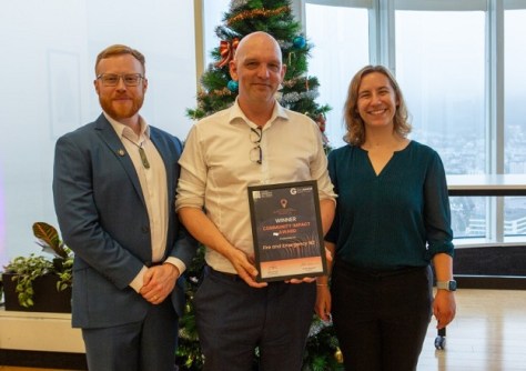
The Award for Community Impact was given to Fire and Emergency New Zealand for its Fire and Emergency Common Operating Platform, a suite of desktop and mobile apps built on ArcGIS, developed in response to critical weather events such as Cyclone Gabrielle.
The Award for Environment and Sustainability was awarded to Kāinga Ora & Beca for The Amenity Access Tool: Helping Kāinga Ora Reduce Their Carbon Footprint. The tool embeds climate change aspects in decision-making processes.
The Award for Innovation in Medium to Large Business, awarded jointly this by S+SNZ and Geoscience Australia, was given to two recipients. The first was awarded to Aurecon for its integration of BIM, GIS and other technologies into the O Mahurangi Penlink project. The second was awarded to Wood and Partners Consultants for GeoTrack, a geospatial solution that uses satellite and IoT technologies to deliver continuous, millimetre-accurate displacement data.
The recipient of the Award for Technical Excellence was WSP New Zealand in collaboration with New Zealand Transport Agency Waka Kotahi, for the Asset Management Data Standards – Network Model, which serves as a single source of truth for transport planning and asset management.
The Award for Workforce Development and Inclusion was given to NZ Emerging Spatial Professionals, a group that has organised more than 50 industry events with the aim of supporting the next generation of spatial professionals.
And finally, as we reported earlier, the LINZ Ron Munro Memorial Lifetime Achievement Award was awarded to Graeme Blick for all his work in the geospatial sector across a long and illustrious career.
Spatial Source adds it congratulations to all the winners and finalists.


