

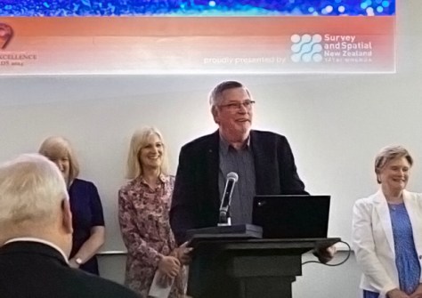
Graeme Blick has become the inaugural recipient of the Ron Munro Memorial Lifetime Achievement Award, presented by Toitū Te Whenua Land Information New Zealand (LINZ) and Survey and Spatial New Zealand.
The new award aims to recognise and celebrate the work of a geospatial professional who has significantly contributed to the advancement, promotion and improvement of the sector in New Zealand.
Blick, an internationally respected expert in geodesy and surveying, recently retired after 54 years in public service, including almost 30 years with LINZ, where he served as Chief Geodesist, National Geodetic Office, and Manager National Topographic Office.
Blick is widely recognised as having positioned New Zealand as a world leader in geodesy and surveying, and was the architect and leader of projects such as:
- The world-leading semi-dynamic datum to which New Zealand migrated in 1998;
- The establishment of GeoNet in 2001, partnering with GNS Science and the then Earthquake Commission (now Natural Hazards Commission Toka Tū Ake);
- The New Zealand national height standard in 2016, which used gravity measurements to produce a surface model of the Earth to determine heights, rather than the traditional use of sea level measurements; and
- The trans-Tasman partnership with Geoscience Australia that led to the development of SouthPAN.
Blick also served for more than 40 years with the New Zealand Institute of Surveyors and Survey and Spatial New Zealand, and more than 25 years each with the International Association of Geodesy and the Scientific Committee on Antarctic Research.
He has also been a member of the Antarctic Names Committee and is still involved as an expert with the United Nations Global Geospatial Information Management agency.


