

Australian geospatial data analytics start-up, MapAI, which specialises in generative AI, has announced the closure of a $1.3 million funding round.
The funding round, supported by FrontierSI and UNSW Sydney, will accelerate the commercial rollout of MapAI’s platform, which takes plain language queries and interprets them to produce presentations of geospatial data.
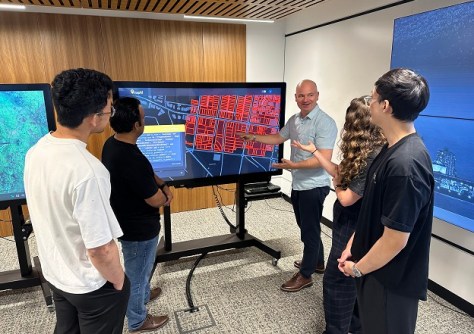
It is MapAI’s generative AI technology that produces the code that sits between the query and the data.
“Generative AI for us means creating geospatial software code that can be executed on data to answer a question,” Phil Delaney, CEO of MapAI, told Spatial Source.
“It’s essentially a link between a person’s question and complex geospatial data, to enable an answer to that question to be found.”
That data can either be a client’s in-house data or publicly available data, or both.
“Early next year we will release a public demonstration version that’s based on openly available data, particularly government data. But the primary aim of MapAI is to help organisations chat-enable their existing data,” said Delaney.
According to Delaney, access to open data made available by government agencies has been vital.
“Our ability to test and showcase MapAI to new customers has really all been driven on the back of open government data,” he said. “And it’s through demonstrating our value through that data that we are then able to help companies and government customers to ‘chat-enable’ their data.”
MapAI is a fantastic Aussie success story, having been incubated within FrontierSI.
“We started a research project about 12 months ago with the UNSW, and FrontierSI spun out the company about six months ago,” said Delaney.
“UNSW is proud to continue our role as the research engine behind MapAI,” said Professor Chris Pettit, Director of UNSW City Futures Research Centre where the foundational technology behind MapAI was developed.
“This funding not only fuels the next stage of development but also cements our commitment to translating our cutting-edge research into real-world products.”
Commenting on the new $1.3 million funding round, the CEO of FrontierSI, Graeme Kernich, said that “Our continued support for MapAI aligns with FrontierSI’s purpose to solve problems using our geospatial expertise”.
“MapAI builds solutions that not only allow users to interact with their data and make better decisions, but is also building tools that provide a broader set of users with information that they simply haven’t had access to in the past,” he said.
“The main purpose of the funding is to help to scale our technology from a beta stage and turn that into a product that anybody can buy and deploy on top of their data,” added Delaney, going on to say that it will also be used to expand “our partnership with the UNSW, because there’s definitely still a research component in this; it’s such new technology”.
Even at beta stage, MapAI has proof of concepts running with Geelong Council, Tamworth Council and ID Consulting, with its first major commercial stream of activity soon to come in delivering the Urban Copilot project with Archistar and Property Exchange Australia (PEXA).
The $6.5 million, three-year Urban Copilot initiative aims to redefine urban planning through advanced AI solutions with MapAI funded as a core technology provider.
Urban Copilot is all about “trying to identify types of land, where development should be happening, and then greatly speeding up the process of working out what is possible and feasible in a location, and then going through the process of actually generating the planning documents that you need to submit to get a development off the ground,” said Delaney.
You can watch video demonstrations of MapAI’s technology on the company’s YouTube channel.


