

The proposed Moonraker lunar LiDAR has been selected for consideration as one of Europe’s next space missions.
The European Space Agency (ESA) has chosen the project for a Phase A appraisal under the agency’s Small Missions for Exploration – Destination the Moon program.
Prime contractor NUVIEW will lead an international consortium advancing the concept for a space-based LiDAR for lunar terrain mapping.
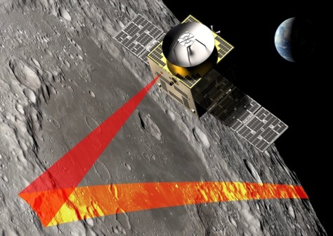
That concept would see the Moonraker spacecraft deploy into lunar orbit to generate high-resolution, 3D elevation data of the Moon’s polar regions and other priority areas.
The resulting terrain models will support landing site identification, hazard assessment and surface planning for future robotic and human missions.
“Moonraker is a direct extension of our commercial LiDAR architecture into lunar orbit,” said Katie Graumann, CEO of NUVIEW Germany.
“By adapting the systems we are deploying for Earth observation, we can provide reliable, mission-critical terrain data that helps reduce risk for future lunar landings and surface operations.”
The importance of mapping the Moon
Moonraker would comprise a single orbiter operating in a low-altitude polar orbit around the Moon.
That orbiter would be a high-performance small satellite capable of providing significant power generation and storage to support the demanding lunar LiDAR payload.
The spacecraft will also need to support precision navigation and payload pointing to enable both the high-resolution mapping and a high-data-rate downlink of data back to Earth.
That data would be processed into 3D digital elevation models to support mission planning and analysis.
The mission would aim to focus on the lunar South Pole and other select areas of interest, including permanently shadowed regions, where accurate terrain data is critical for evaluating potential landing sites and supporting future exploration and resource utilisation activities.
During the Phase A study process, the Moonraker team will further mature the mission concept, refine system requirements, and assess technical and programmatic feasibility.
Hollywood actor is a lunar LiDAR champion
NUVIEW is talking up the fact that Hollywood actor Leonardo DiCaprio is an investor in the company.
That’s because, aside from Moonraker, NUVIEW is building a constellation of LiDAR-equipped satellites to provide persistent, global 3D elevation data of Earth from orbit.
DiCaprio, who is also a passionate environmentalist, recognises the importance of accurate terrain intelligence for responsible exploration.
“Understanding the Moon through high-resolution 3D mapping allows us to make smarter, safer decisions,” he said.
“Technologies like NUVIEW’s space-based LiDAR strengthen exploration while reinforcing the importance of Earth observation and environmental intelligence as humanity expands beyond our planet.”


