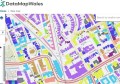
The NSW Land & Property Information (LPI) this week released its NSW Globe, which places authoritative data from across NSW onto Google Earth.
By installing the NSW Globe KML into Google Earth, you can view NSW maps, data, and imagery – including data owned by NSW Government and data used under license from other parties. It can also be run from a compatible smartphone or tablet, using the Google Earth app.
LPI medium to high resolution imagery and elevation data can easily be viewed in this application, as well as private sector high resolution airborne and satellite imagery. It also contains imagery datasets covering past and current emergency events for flood and fire, as well as historic 1943 imagery covering most of Greater Sydney, allowing change detection.
Some of the layers you can choose to view include:
- Imagery (medium and high resolution aerial, satellite both government and private sourced)
- Additional imagery (1943 Sydney Historic, Emergency Services)
- Terrain data (25m DTMS, 5m DTMS, LiDAR and SRTM various locations)
- Places (e.g. population centre, suburb, other places)
- Boundaries (e.g. coastline, local government, localities, electoral state and federal)
- Roads (e.g. arterial road, minor road, other)
- Rail (e.g. railway line, railway station)
- Addresses (property and address)
- Land parcel (e.g. lot and deposited plan, property boundary, labels)
To start using the NSW Globe, visit http://globe.six.nsw.gov.au/.