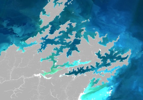
New Zealand scientists have mapped suspended sediment and phytoplankton blooms using satellite imagery.
Satellite remote sensing is being used to monitor coastal change in water temperature, suspended sediment concentration, phytoplankton abundance and water clarity at the NZ national scale (SCENZ, or Seas Coasts and Estuaries New Zealand).
However, at 500 metres resolution, SCENZ observations are often missing for the 1 to 2 kilometres closest to shore and in narrow inlets, estuaries, harbours, sounds and fiords.
Working with the Plymouth Marine Laboratory, a team of researchers has trialled 60-metre satellite imagery to get a better picture of these events and their impacts on New Zealand’s inshore marine environment.
The work is demonstrating a higher-resolution capability that could be rolled out along the country’s coastline.
Using Sentinel-2 60m spatial data
Earth Sciences NZ principal scientist Dr Matt Pinkerton says high sediment loads in the marine environment can cause ecological and socio-economic damage.
“Many parts of New Zealand’s coastal domain are changing due to climate effects and the input of sediment and nutrients from rivers,” he said.
“In situ monitoring is not capable of providing a full picture of environmental change around the whole coasts. For example, you can see the effect of extreme weather events bringing sediment down rivers, or where blooms may be caused by nutrient run off.”
Funded by UK Research and Innovation, new satellite data was obtained from the European Space Agency’s Sentinel-2 satellite, providing images at 60 metres resolution every 5 days for the last 10 years.
Four test areas were selected: the Hauraki Gulf and Kaipara Estuary, the Marlborough Sounds, the Canterbury Bight (including Lake Ellesmere and Akaroa Harbour), and Fiordland.
“While lower resolution satellite data works for some of our more open coastlines, there are narrower areas, such as the Marlborough Sounds, Kaipara Harbour, Lakes Ellesmere and the Southland Fiords, where the terrestrial signal can distort the picture and make the results unreliable or entirely missing,” said Pinkerton.
Vital insights into coastal change
The method proved highly successful, enabling the researchers to track concentrations of suspended sediment and phytoplankton between 2016 and 2025, providing spatial maps of coastal change over this period.
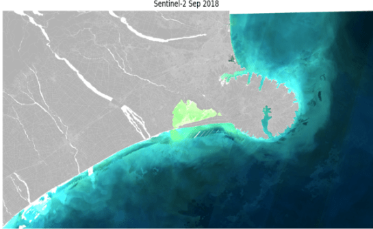
Pinkerton says the researchers are keen to see the method rolled out for the entire New Zealand coastal zone, allowing it to be monitored with greater precision in the future.
“Many other New Zealand coastal areas have high ecological, economic and cultural significance and would benefit from Sentinel-2 data observations being available for analysis,” said Pinkerton.
“Because we’ve proven it can work in these areas which were traditionally tricky, it would work to extend Sentinel-2 observation capability to the whole New Zealand coastline.
“This will offer vital insights into what is causing coastal change in different areas.”