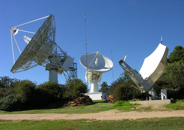
Lockheed Martin Australia’s satellite communications facility at Uralla in NSW.
Geoscience Australia has awarded the local arm of Lockheed Martin a $1.18 billion, 19-year contract to help implement the Southern Positioning Augmentation Network (SouthPAN).
SouthPAN aims to deliver a signal augmenting GPS and Galileo over the Australasian region, improving accuracy from 5 to 10 metres, to within as little as 10 centimetres.
The SouthPAN signal will be of value for a range of sectors, including surveying, civil aviation, vehicle guidance, precision agriculture, maritime navigation, drones and other unmanned vehicles.
“Space is among our fastest growing areas, and our local technical team will play an important role in delivering the benefits of SouthPAN capability to service many sectors including aviation, agriculture, transport, mining and other industries,” said David Ball, Regional Director of Space for Lockheed Martin Australia and New Zealand.
Lockheed Martin Australia will work with the SouthPAN project team to establish a network of GNSS reference stations and satellite uplink facilities that will enable communications with the SouthPAN space infrastructure.
SouthPAN is being implemented as a partnership between Geoscience Australia and Toitū Te Whenua Land Information New Zealand (LINZ) under the Australia New Zealand Science, Research and Innovation Cooperation Agreement.
Stay up to date by getting stories like this delivered to your inbox.
Sign up to receive our free weekly Spatial Source newsletter.


