

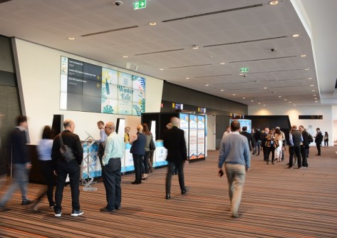
The full program for the Geospatial Council of Australia’s (GCA) Locate24 conference is now available for download.
The conference will kick off on Tuesday, 7 May with 11 different workshop streams… covering topics such as harnessing synthetic aperture radar for hazard monitoring, leveraging digital twins for local government, progress on the ICSM Cadastre 2034 project, hands-on satellite imagery training for NSW government agencies and councils, and many more.
The workshops will be followed by the official conference welcoming reception (canapes and drinks), beginning at 5:00pm.
The main program on the 8th and 9th of May, will comprise four plenary sessions plus technical workshops and concurrent speaker sessions.
The opening plenary will be chaired by Kate Lundy, Chair/President of the GCA, who will unveil the highly anticipated ‘Economic Impact of Geospatial Information’ report. She will be joined by Narelle Underwood (NSW DCS Spatial Services), Martine Woolf (Geoscience Australia) and Paul Farrell (NGIS), who will present industry case studies.
The second plenary will focus on ethics and governance in the field of generative AI, with a panel of experts — featuring Ian Oppermann (Service Generation), John Valastro (Simplyai) and Prof. Fang Chen (UTS Data Science Institute) — to discuss the governance of AI and how it will affect the geospatial sector.
The third plenary, titled ‘Sustainable horizons: Integrating culture, community and environment for a brighter future,’ will bring together Prof. Deen Sanders (University of Newcastle), Rory Brown (Transport for NSW), Dyan Currie (Brisbane City Council) and Dr James Johnson (Geoscience Australia) to lend their expertise to a thought-provoking discussion covering a diverse range of topics including indigenous mapping, smart cities, economic growth and sustainable development.
The fourth plenary will bring together leaders such as Brian Nicholls (Woolpert), Lisa Bush (Geoscience Australia), Dr Victor Khoo (Singapore Land Authority), Prof. Sisi Zlatanova (UNSW) and Tony Wheeler (GCA) to share their experiences, insights and applied learnings on how current and emerging geospatial programs, technologies and trends are shaping the future of geospatial ecosystems.
The overall speaker program will see a who’s who of the Australian geospatial sector come together to provide overviews of developments across wide variety of topics — GIS, surveying, hydrography, remote sensing, aerial imagery, LiDAR, 3D, BIM, PNT, spatial data and more — all aimed at offering solutions to problems and challenges faced by the wider community. Here’s just a small selection to illustrate the range of the presentations on offer:
- The value of PNT in underwriting Australia’s GDF — Martine Woolf (Geoscience Australia)
- Extending your GIS toolkit for science and research — Dr Sharyn Hickey (UWA) and Jennah Williams (Esri Australia)
- Faster, smarter, stronger disaster response — Ericka Martin (Planet Labs)
- Spatial Vision’s Women in Spatial Program — Amanda Tyrer (Spatial Vision)
- Transforming environmental monitoring with AI — Nathaniel Jeffrey and Dr Yang Chen (Department of Transport and Planning, Victoria)
- Machine Learning to aid in bathymetric LiDAR data processing — Mick Hawkins (Fugro Australia)
- Capturing history: Digital twin of heritage buildings — A/Prof. Zahra Gharineiat (UniSQ)
- Automating building code compliance through integration of geospatial AI and BIM — Nikoo Mirhosseini (University of Melbourne)
- How spatial is at the centre of smart places — Rory Brown (Transport for NSW)
The full program can be viewed and downloaded from locate.geospatialcouncil.org.au/program.
A highlight of the conference will be the presentation of the annual Geospatial Excellence Awards, which will take place during the Gala Dinner on the evening of 8 May. Tickets can be booked during the conference registration process at locate.geospatialcouncil.org.au/registration.


