New Zealand’s official mapping agency is looking for new members to join its 3D Coastal Mapping Advisory Group.
Toitū Te Whenua Land Information New Zealand (LINZ) has issued an invitation to organisations who are interested in helping the agency progress its mission to map much of the country’s coastline in 3D.
Membership of the 3D Coastal Mapping Advisory Group is open to government, iwi (First Nation’s peoples), science, academia, industry and community groups.
The aim of the Group is to gather extra expertise and perspectives to help show how high-resolution data of the coast and seafloor can support hazard modelling and planning, climate adaptation, safeguarding cultural heritage, and community resilience.
“This group connects high-quality coastal data with the people who can apply it to real-world challenges,” said Program Lead, Stuart Caie.
“Communities face big decisions about where to build, what to protect and how to respond to the impacts of a natural hazard. Each use case helps show what this data can deliver and gives decision makers better information to work from.”
Contributing to coastal causes
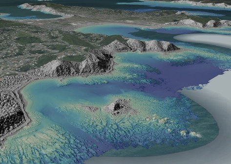
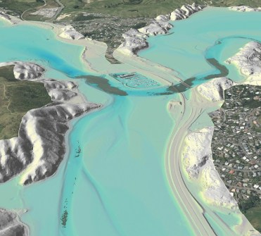
The 3D Coastal Mapping program began in late 2023 and is scheduled to run to June 2028. It is mapping up to 40% of New Zealand’s coastline, focusing on populated areas, significant infrastructure and places at greater risk of coastal inundation.
Possible uses for the data include:
- tsunami and storm-surge modelling;
- coastal erosion assessments;
- understanding coastal processes;
- supporting search and rescue operations; and
- detecting changes to the coastline.
Members of the Advisory Group work with the program team to test and record how the data benefits their work. They join when data relevant to them becomes available and generally stay involved until their use case is complete.
This flexible approach means a wider range of organisations can contribute over the life of the program.
The next intake opens in March 2027 when new data will be available. Organisations interested in becoming involved can register their interest by emailing 3DCM@linz.govt.nz.
The Progress Tracker on the LINZ website shows which areas have been published, as well as upcoming areas, and the quarter in which new data could become available.
Related reading:
New Zealand’s new coastal LiDAR data milestone
High-resolution coastal LiDAR point cloud data
LINZ begins 3D LiDAR mapping of NZ’s coastline
First data from $4.5m WA coastal mapping project