The 3rd International Conference on Indoor Positioning and Indoor Navigation (IPIN’12) will take place at the University of New South Wales, on the 13-15th November 2012.
WHEN: 2012-11-13 to 2012-11-15
WHERE: University of NSW, Sydney
STATE: NSW
COUNTRY: AUS
The 3rd International Conference on Indoor Positioning and Indoor Navigation (IPIN’12) will take place at the University of New South Wales in Sydney, Australia, on the 13-15th November 2012. Organised by the School of Surveying and Spatial Information Systems, its aim will be to consolidate its position as the foremost conference dedicated entirely to indoor positioning and navigation, building on the success of IPIN’10 and IPIN’11.
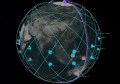
As is well known, satellite navigation systems locate people or assets with ease outdoors, when a clear view of the sky is available. However, indoors or in deep urban canyons, reflections and blockages of satellite signals degrade the accuracy of the position, or prevent positioning altogether. This means that one of the main challenges to growth of the positioning industry, and location based services in particular, is the ability to position indoors.
This year, IPIN’12 will be organised in close partnership with key industry players in the field, with participation from well-known companies such as Google, Nokia or Aeroscout already secured. Gathering all the best academics and companies actively working on indoor positioning and navigation, IPIN’12 is the place to be this year if you want to learn more about this field, and for networking with positioning experts.
For more information visit www.surveying.unsw.edu.au/ipin2012/