

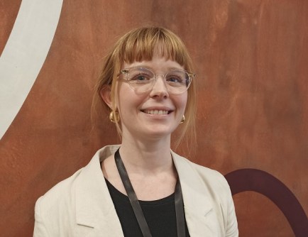
This coming Sunday, 11 February is the International Day of Women and Girls in Science. In honour of the occasion, we bring you this interview with a rising star of the Australian geospatial community, Tori Murrant.
Tori Murrant is a GIS analyst in the 3D spatial team at Monteath & Powys, where she leads the company’s GIS-based initiatives to enable the creation and accessibility of 3D data. This includes delivering enterprise database systems and platforms for storage and access of spatial information. At home, she is mum to her two-year-old son. “Yes, I am addicted to coffee,” she says.
We spoke with Murrant to find out how she chose her career and why she has become so passionate about 3D.
How did you get into this field?
I stumbled into the field while completing the mandatory GIS course in my undergraduate degree in geology. I found that I had a strong affinity for the software as it seemed like an extension of video games — I got my start in coding and 3D meshing by modding games in my teens. Previously, I have worked at the Geological Survey of NSW, City of Newcastle and NSW Spatial Services. My career has been focused on 3D spatial; whether that’s basin geology, cadastres or buildings.
What sort of projects do you work on?
As I work for a surveying firm, my work is based in the land administration, architecture and engineering fields. As part of the 3D spatial team, I’m often creating platforms for the visualisation and querying of building information model data to make it accessible to non-spatial stakeholders. However, the project taking up most of my time right now is co-ordinating the enterprise spatial strategy for an organisation managing the closure of coal-fired power plants and transforming their 2D information to 3D.
What do you find so enjoyable about your work?
Most data have a location element, and the importance of spatial intelligence across all industries is being realised. I enjoy the variety of opportunities that this presents; I can apply my skills at an environmental or surveying firm or at an academic institution. On that note, I really enjoy seeing the work shared by my colleagues in different industries. Additionally, I find solving 3D spatial problems to be like playing a video game (and sometimes it is when I use Unreal Engine!). I’m excited to be a part of the future of 3D in the geospatial industry.
What do you think of the culture of Australia’s geospatial sector?
I have found the sector to be supportive and full of passionate individuals who want the share their knowledge. I’ve been lucky to have previously been a part of the team delivering the NSW Spatial Digital Twin and Cadastre NSW. I had the opportunity to learn from some truly innovative professionals who were passionate, intelligent and always willing to include me. My positive attitude has been created by the leaders I have learned from, and I am grateful for the mentorship I have received.
Do you have any specific ambitions for the years ahead?
I have a handful of aims for the years ahead. I’m planning to commence postgraduate research next year while continuing my current role. I want to share my knowledge of geoBIM with the geospatial industry and help build our collective understanding of this emerging space to realise its value. I would like to expand my professional network and build my leadership skills for my broader career goal to become a leader for organisations to adopt spatial digital twin technologies through collaboration, thought leadership and change management.
Are there any other points you’d like to make?
I come across a lot of people who are confused about the value of 3D data, so I want to make a point about open 3D spatial data. If we are to attract new talent, advance the industry and create value, we need access to open data for people to explore their creativity and practice new skills. I encourage organisations to adopt a strategy for sharing 3D spatial data publicly (where possible) so that we can start having people being less wary of working in 3D and make it the new normal.


