

The building and construction industries boomed throughout the pandemic despite the substantial challenges of lockdown-limited movement and supply change shortages. Maintaining and increasing profitability with these ongoing difficulties and rising interest rates presents a challenge to the industry, but a challenge that can be helped by finding better ways to work.
MetroMap’s aerial imagery subscription service is already helping the building and construction industries work smarter. Whether conducting detailed site inspections, taking accurate ground measurements, monitoring project change, seeing detailed land and building information, or accessing years of historical imagery without ever leaving your office, MetroMap saves both time and money.
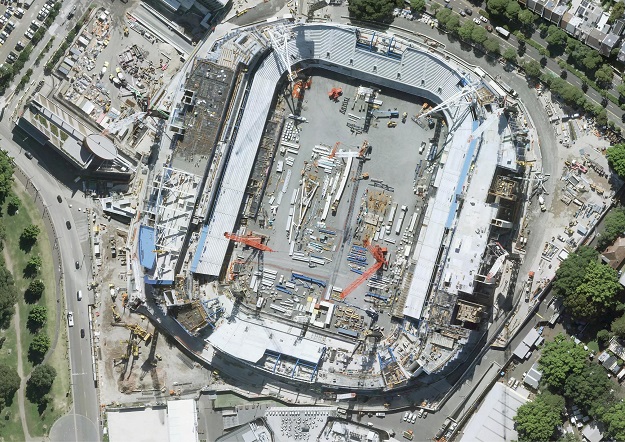
THE BIG PICTURE AND THE PRECISE DETAILS
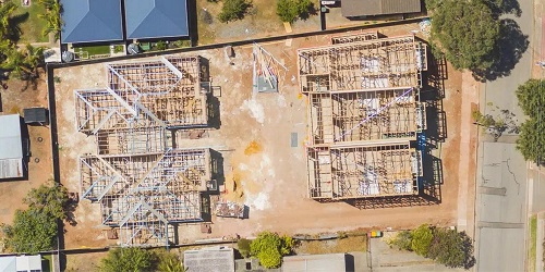
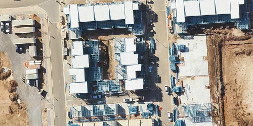
The MetroMap platform gives users access to super high-resolution and spatially accurate aerial imagery covering more than 8.5 million Australian dwellings and millions of square kilometres in total, all within an easy-to-use web browser platform. They can see an entire city and zoom down to the ground level to check finer details at the individual property level. Site planning, monitoring and assessment have never been easier. Industry professionals can now open MetroMap, find the site of interest, and use the in-built tools to get their information.
MetroMap’s measurement tools give you accurate ground distances, areas and perimeters. Users can create projects and save them to their profile to be available on any device with a web browser. Thanks to accurate measuring tools, subscribers save travel time and reduce unnecessary site visits when they don’t need detailed property surveys.
Additional data layers within MetroMap give specific details on existing properties and buildings. You can view zoning, size and area figures, detailed roof information and other features from Geoscape’s trusted building footprint data. Additional cadastre records provide detailed property information, including the land category and government jurisdiction information.
PROPERTY HISTORY
Now users can rewind the clock with decades of archival imagery of Australian capital cities. MetroMap captures new imagery of capital cities and major towns 2 to 4 times per year. Building and construction industry users can see how a building or site has changed over the years or even monitor completed projects into the future. Large expenditures and property acquisitions demand scrutiny, and aerial imagery can provide years of insight that alter purchasing decisions.
ACCESS METROMAP DATA YOUR WAY
The base individual user accounts include access to the web application, the complete image library, measuring tools and unlimited data. Those desiring more advanced features can choose accounts with additional access to georeferenced, highest-quality image downloads and optional property and building feature layer add-ons. Large enterprises build flexible plans according to their team size, feature and data needs.
MetroMap’s API-based access is popular among larger organisations and more advanced users who want to add the imagery to their existing project planning systems. MetroMap powers many large enterprises across the public and private sectors that trust the platform’s spatial data as one of their information streams.
WHAT METROMAP USERS SAY
MetroMap shows the big picture and the fine details all in one platform for land developers. Coverage of the booming regional towns makes remote research possible.
Graeme Gibson, Property Development Manager from Oakford Homes, explains how MetroMap integrates into his workflow:
“Aerial imagery shows me key issues up-front. It’s saving time immediately because it cuts out the need for site inspections for that initial analysis. I can look at the allotment patterns, understand streetscaping as well as review proximity to schools, activity centres and recreational facilities,” he said. “The ability to review the aerial history of a site is extremely important as it gives a holistic picture of previous uses and allows me to accurately determine what has occurred on a site. The fact that all of this can be done in a matter of minutes is the biggest benefit.”
LEARN MORE
Learn more about how MetroMap can help your Building and Construction business: https://metromap.com.au/builders.


