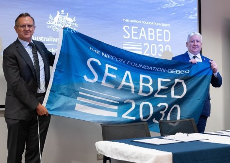
Geoscience Australia has signed a new partnership with the Nippon Foundation-GEBCO Seabed 2030 Project, an initiative that aims to accelerate ocean floor mapping by the end of the decade.
The partnership agreement was signed by Dr James Johnson, Chief Executive Officer of Geoscience Australia (GA), and Seabed 2030 Director, Jamie McMichael-Phillips, at a ceremony held at Geoscience Australia’s headquarters in Canberra.
Under the collaboration, GA will play an active role in supporting Seabed 2030’s mission by contributing vital bathymetric data to further enhance the global understanding of the seafloor.
A key component of this is the AusSeabed initiative, a national seabed mapping collaboration that co-ordinates and publishes seabed mapping data from across the Australian region.
GA will provide high-quality, accessible AusSeabed mapping data, bolstering Seabed 2030’s efforts to create a seamless digital map of the world’s ocean floor.
“We are thrilled to formalise our partnership with Seabed 2030 and join in the global effort to map the world’s seabed by 2030,” said Dr Johnson.
“Welcoming Geoscience Australia as a partner marks a significant step forward in the global pursuit of a fully mapped ocean floor,” added McMichael-Phillips.
“This partnership underscores the power of collaboration across national and regional boundaries, drawing on Australia’s breadth of seabed data and expertise.
“Together, we are moving closer to achieving a comprehensive map of the ocean and we look forward to working closely with Geoscience Australia to advance our ambitious mission.”
GA’s Head of Oceans, Reefs, Coasts and the Antarctic Branch, Dr Jodie Smith, said that Geoscience Australia has committed to providing data to Seabed 2030 on behalf of the Australian seabed mapping community.
“We publish seabed mapping data through the AusSeabed data portal, and this data supports decision-making across a range of marine applications, including offshore renewable energy, hazard modelling and marine park management,” said Dr Smith.
As an island nation, Australia has one of the largest marine jurisdictions in the world and is responsible for around 4% of the world’s oceans.
“To manage this resource sustainably, seabed mapping data is necessary because it allows us to better understand the environment, which improves decision-making and supports the sustainable growth of Australia’s ocean economy,” said Dr Smith.
“We have made great progress, but there is a lot more work still to be done.”
Geoscience Australia will reprocess, review and publish valuable archives of legacy offshore data, and collate it with new offshore data, to better understand the geology and geography of the seabed.
All data collected and shared with the Seabed 2030 project is included in the free and publicly available GEBCO global grid.