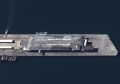
Po Valley, Italy, captured by Sentinel-2A , 29/06/2015. Copyright: Copernicus data (2015)/ESA
Sentinel-2A, the first optical Earth observation satellite in the European Copernicus programme, was successfully launched last week by Airbus Defence and Space. On 23 June, a Vega launcher took off from the spaceport in Kourou, French Guiana, carrying the satellite developed and built under the industrial leadership of Airbus Defence and Space for the European Space Agency (ESA). After just over one hour, the solar panel needed to supply energy was extended and Sentinel-2A successfully reported in “for duty.” The 1.1 tonne satellite has been designed to operate for at least seven years and three months in a polar orbit around 780 kilometers above the Earth.
“The outstanding performance capabilities of Sentinel-2’s multispectral instrument along with its rapid data transmission ability will soon be available, marking a major step forward in satellite-based Earth and environmental observation,” said Francois Auque, Head of Space Systems at Airbus Defence and Space.
Airbus Defence and Space claim he Sentinel 2 mission will contribute to the management of food security by providing information for the agricultural sector. It will also enable the condition of and changes in land surfaces to be mapped and forests worldwide to be monitored. The mission will provide information about the pollution of lakes and coastal waters. Images of floods, volcanic eruptions and landslides will aid the production of disaster maps and facilitate humanitarian aid activities.
The mission is based on a constellation of two identical satellites, Sentinel-2A and Sentinel-2B. Sentinel-2B will be launched in 2016 into the same orbit, but it will be 180°apart. It will take both satellites five days to cover the Earth between the latitudes of 56° south and 84° north, thus optimising the global coverage zone and data transmission for numerous applications. Sentinel-2B is being worked on in the cleanrooms of Airbus Defence and Space and will be ready for launch in 2016.
The imaging instrument, which uses 13 spectral channels ranging from the visible to the infrared, delivers high-resolution multispectral images of the Earth’s surface with a resolution of up to 10 metres at an image width of 290 kilometres. This large scanning width results in wider coverage, while at the same time, the advanced instrument provides an unprecedented level of detail.
Sentinel-2 is also capable of using another ESA programme, the European Data Relay System (EDRS). EDRS will be a network of laser communication payloads on geostationary satellites and low Earth orbit satellites.
To view more images, see the latest ESA article on the Sentinel mission.