Cloudless Earth imagery access

By on 25 March, 2024

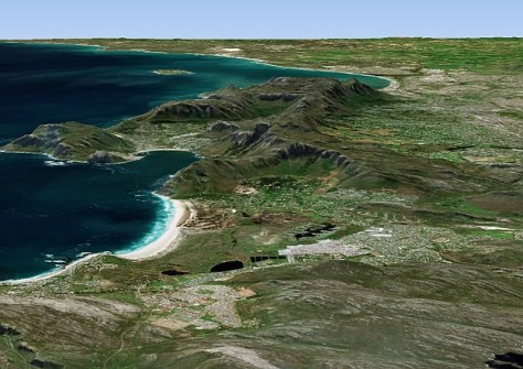
French firm Kermap has released Nimbo, a free web platform enabling access to time series 2D and 3D cloudless satellite views of the Earth.

The company says it relies on innovative AI methods to process, clean and homogenise Copernicus Sentinel 1 and 2 ten-metre resolution satellite imagery, while catering to the needs of GIS professionals by providing API access to its monthly basemaps from any GIS software, including a dedicated QGIS plugin.

It adds that the clarity and homogeneity of its Earth Basemaps make them suitable for geospatial applications based on machine learning: time series analysis, object extraction and change detection.

You may also like to read:


, ,


Newsletter

Sign up now to stay up to date about all the news from Spatial Source. You will get a newsletter every week with the latest news.

Geospatial in the age of the metaverse
The geospatial sector is set to both underpin the metaverse ...
$140 million allocated for WA Spatial Digital Twin
The 10-year project aims to improve infrastructure delivery,...
March 21: Celebrating Global Surveyors’ Day
March 21 is the day on which we celebrate the essential work...
Government releases new Local Drone Rules map
UAV users can now easily see whether they need to obtain aut...
Photogrammetry with enhanced cloud capabilities
SimActive has announced improved cloud environment enhanceme...