

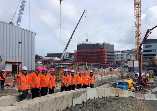
Representatives from LINZ, CRLL, CKL Surveys and Simpson Grierson at the City Rail Link project, Mount Eden end.
Toitū Te Whenua Land Information New Zealand (LINZ) and City Rail Link Limited (CRLL) are collaborating to ensure the integrity of ownership and protection of not only the railway stations and tunnel infrastructure along Auckland’s new City Rail Link (CRL), but also the subsoil surrounding the infrastructure.
The CRL, established by the New Zealand Government and Auckland Council, will comprise a 3.45km twin-tunnel underground rail link up to 42 metres below Auckland City, linking Britomart to Mount Eden. It will eventually accommodate up to 54,000 passengers per hour at peak travel times.
The collaboration between LINZ and CRLL aims to ensure that future use of the land and subsoil, be it private or public property, or road, is minimally impacted by the tunnel and rail stations.
LINZ Principal Cadastral Surveyor, Mike Morris, says the CRL survey is not without its challenges.
“The magnitude of the project is not so much the huge quantity of data coming through, but the complexity of the information which makes it such a significant project,” he said.
“New Zealand was ground-breaking in its introduction of a two-dimensional cadastre in the early 2000s; the current redesign of the system, Landonline, is the start of a journey to a fully 3D land information system.”
Rick Galli, CRLL Head of Property, says the collaboration project has only just commenced and will be a long journey.
“Geo-referencing in 3D is really exciting and it will be fascinating to see where LINZ is going with it,” he said.
Both public entities share a duty of care to look after New Zealand’s land and environmental resources, so they are sustained for future generations.
“Land and property are finite resources requiring protection to ensure their use can be maximised, which is also a key purpose of LINZ,” said Galli.
“CRLL has engaged with LINZ across multiple points in the project, including acquisition under the Public Works Act, willing purchase negotiations, the naming of rail stations (through the New Zealand Geographic Board), meeting survey standards and ensuring the Cadastral Survey Datasets are compliant and fit for purpose.”
According to Morris, “historically, the amount of rework required to achieve compliance with the required survey standards is high, and the more complex the surveys, the more difficult it is to achieve first-time compliance”.
“LINZ has an objective to work with surveyors to help them improve first-time compliance. This project is a good opportunity to test that objective.”
Non-compliance is an issue that both adds cost to projects and ties up valuable LINZ resources. LINZ plans to be the ‘fence at the top of the cliff’ helping companies provide correct and compliant information, Morris says.
Galli says CRLL is delighted to collaborate with LINZ, as it is imperative New Zealand has a “world-class property system where people can own, transact, develop and invest in land and property with confidence”.
The need for quality, high-value geographic and property information is self-evident, but given the nature of the CRL project, it is complex to deliver, he says.
In preparation for the lodgement of the Cadastral Survey Datasets, staff from both entities met to ensure mutual understanding of the methodology for what will be complex land and sub-soil surveys.
“With that level of understanding, LINZ staff can now work with the surveyors to maximise the opportunity for how the surveys are captured and depicted,” said Galli.
“Given the scale of the CRL project, and the importance in establishing robust Cadastral Survey Datasets along the route, the parties were able to share their individual thoughts about what they imagined were important issues relating to the surveys, their integration with the cadastre, and the spatial integrity of the current parcel fabric,” added Morris.
“There was good commonality, but it was also healthy to note sufficient differences to warrant the continued collaboration.”
“We are keen to ensure the Cadastral Survey Datasets are prepared in such a way that the data will be aligned with the requirements for the future 3D cadastre,” said Galli.
The multi-year survey project will capture land parcel data that can be viewed in 3D in future, once the 3D cadastre is released.
Bringing this project to life in 3D will give a much clearer picture of what the infrastructure looks like below the surface of each overlying property.


