


The Geospatial Council of Australia’s World Hydrography Day Seminar will dive deep into the latest advancements in hydrographic surveying, mapping technologies and data analysis techniques.
The event will give delegates the opportunity to connect with fellow professionals, share experiences and learn from industry leaders at the forefront of marine charting and exploration.
For both seasoned experts and those just starting out in the field, the event promises invaluable insights and networking opportunities to enhance skills and advance careers.
Image credit: ©stock.adobe.com/au/HENADZ

In 2024, the International GNSS Service (IGS) will celebrate 30 years of operational service, having commenced on 1 January 1994.
The University of Bern together with the partners from the CODE consortium — AIUB: Astronomical Institute of the University of Bern; swisstopo: Swiss Federal Office of Topography; BKG: Federal Agency for Cartography and Geodesy, Germany; IAPG/TUM: Institute for Astronomical and Physical Geodesy, Technical University of Munich — invites the GNSS community to celebrate the IGS’ third decade with a symposium and workshop in Bern, Switzerland.
The in-person event is planned for the week from 1 to 5 July in 2024 and will take place in two parts: symposium (1-4 July) and workshop (4-5 July).
The IGS is a service of the International Association of Geodesy (IAG), its Global Geodetic Observing System (GGOS), The International Union of Geodesy and Geophysics (IUGG), and a network member of the International Science Council (ISC) World Data System (WDS).

The United Nations Committee of Experts on Global Geospatial Information Management (UN-GGIM), in collaboration with the Government of México through Instituto Nacional de Estadística y Geografía (INEGI) will convene the Seventh High-level Forum on United Nations Global Geospatial Information Management with the theme ‘Accelerating Implementation: Achieving Resilience’.
This seventh edition of UN-GGIM’s High-level Forums will continue UN-GGIM’s regular high-level, multi-stakeholder discussions on global geospatial information management, through the convening of global forums, aimed at promoting comprehensive dialogue among member states, and between member states and relevant international organisations, UN system entities and stakeholders.
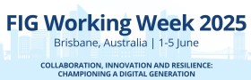
The International Federation of Surveyors (FIG) Working Week 2025 will be held at the Brisbane Convention & Exhibition Centre from Sunday, 1 June to Thursday, 5 June 2025.
The theme for the event will be: Collaboration, Innovation and Resilience: Championing a Digital Generation.
The Convenor for FIG Working Week 2025 is Steve Jacoby, Executive Director, Spatial Information at Department of Resources (Queensland) who has 23 years’ experience as a Senior Executive with the Queensland and Victorian Governments, leading their Spatial Information businesses. Steve has a keen interest in information management and seeing the use of spatial information reach its potential within government, business and the public.
The Program Chair is surveyor, Peter James who is the Business Development Manager, Cohga an Australian company with a focus on the development of IT products, and the provision of associated professional services. Peter is also the son of Earl James, Australia’s first and only FIG President.
FIG Working Week 2025 is a great opportunity for Australia’s geospatial community to showcase their technical expertise, strong research capability and warm hospitality.


