The 9th International Conference on Cartography and GIS will take place in Nessebar, Bulgaria from 16 to 21 June 2024. The ICCGIS is a biannual conference that began in 2006 and has been held every two years since (except for 2020). In total, the Conference has attracted attendees from more than 60 countries and has published more than 700 scientific papers in its proceedings.
The aim of the conference is to collect knowledge and share experiences about the latest achievements in the field of cartography and GIS. Multiple parallel events will take place during the conference, including annual meetings of ICA commissions and a special ISDE plenary session. There will also be a Seminar on Disaster Risk Reduction – Solutions and Innovations.

The Geospatial Council of Australia’s World Hydrography Day Seminar will dive deep into the latest advancements in hydrographic surveying, mapping technologies and data analysis techniques.
The event will give delegates the opportunity to connect with fellow professionals, share experiences and learn from industry leaders at the forefront of marine charting and exploration.
For both seasoned experts and those just starting out in the field, the event promises invaluable insights and networking opportunities to enhance skills and advance careers.
Image credit: ©stock.adobe.com/au/HENADZ

FOSS4G Perth is a local, community-driven gathering of the Perth open geospatial community, focused on sharing news of developments in free and open-source software for geospatial applications.
The event will be an opportunity to share ideas about open-source tools, such as QGIS, PostGIS, OpenStreetMap, Sentinel-2 satellite imagery, Python-based Earth observation libraries and frameworks, GDAL, and many others.
This year’s event will be held in conjunction with the ISPRS Technical Commission IV Symposium.
The 2024 FOSS4G Perth organising committee comprises:
- Bryan Boruff – University of Western Australia
- Cholena Smart – Mammoth Geospatial
- Grant Boxer – Consultant Geologist
- Ivana Ivanova – Curtin University
- John Bryant (Chair) – Mammoth Geospatial
- John Duncan – University of Western Australia
- John Lang – Consultant
- Keith Moss – WA Government
- Michel Nzikou – DMN Solutions
- Nimalika Fernando
- Petra Helmholz – Curtin University
- Piers Higgs – Gaia Resources
- Renee Manser
- Stafford Smith
- Tracey Cousens – Mineral Resources Limited
- Vincent Dinh – GIS Pro

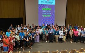
The 2024 Pacific Islands GIS & Remote Sensing Users Conference is reputably the largest GIS and remote sensing conference attended by Pacific Islanders, who leverage this annual opportunity to network and pursue partnerships with practitioners from around the globe.
The conference spotlights the latest innovative technologies, promotes knowledge and capacity development and sharing of best practices, and attracts a gathering of more than 300 attendees.
The theme for the 2024 event will be ‘Sustainable management of coastal areas through remote sensing and GIS.’


