


Held on Sunday, 9th February, 2020, the SSSI National Bushfire Recovery Map-a-thon was a way for the national and international community to work together to map a total of 2,793,879 hectares affected by recent Australian bushfires with the focus being on burnt infrastructure. Join us for this Webinar to hear more about the initiative.
Speakers:
Dr Lesley Arnold (SSSI National Board Director) will give an overview of the Map-a-thon initiative and discuss overall logistics of planning; industry, government and NGO engagement; the challenges and overall execution of the event.
Nathan Eaton, Executive Director, NGIS Australia will give an overview of the technical set-up of this mammoth Map-a-thon and highlight some of the challenges and triumphs experienced.
This is a free event open to those who participated in the Map-a-thon or are involved in the surveying and spatial community.
Details about how to join the Webinar will be emailed to you prior to the event.
To read more about the SSSI National Bushfire Recovery Map-a-thon see the news item here
Speaker:
Rebecca Price is the Principal Policy Officer, Land Management Policy | Energy, Environment and Climate Change at DELWP.
Rebecca will be presenting on the update of the Marine and Coastal Policy that was recently released. Join in the questions and answers after the presentation.
If you are involved in sea level implications from beach erosion, storm surges, the tidal interface, land tenure etc, don’t miss this webinar!
Second speaker to be announced.
Cost
Member FREE | Non-member $45
Contact
Are you a young surveyor and always wondered what the digital frontier of the profession looked like? Are you mid career but developed foundation skills but have not yet ventured into the digital data part of the discipline? Are you a seasoned professional who loves to see what amazing things you can do with the tools and technologies of the 21st century?
If you answered yes to any of those questions then this is a webinar you won’t want to miss!
Michael Finlay is a Geospatial Engineer who specialises in 3D laser scanning and point cloud technologies. He is an early career professional who has been working at Jacobs for 8 years and is passionate about all things 3D laser scanning, especially mobile laser scanning (MLS). Michael is a trail blazer in developing the digital data team and discipline at Jacobs as not only a real value add, efficiency but product and service enricher for the surveying team. He gets involved with the planning, scanning, processing, adjusting, classifying, extracting, automation, analysis, visualisation and supports the interfaces of surveying and digital engineering and GIS environments for stakeholders from a broad variety of disciplines.
Check out Michael’s profile to see some of the amazing projects he has been involved in and how he champions this modern digital space for surveying and geospatial engineers.
Registration
By registering below, you receive access to the watch the webinar live OR if you can’t watch it live, you receive the link to the recording 24 hours after the event date. You can then watch the recording at your leisure.
CPD
This event is worth one SSSI CPD Point. BOSSI points to be confirmed.
Note, only the individual registered for the event is entitled to receive the associated CPD points.
Contact
Katie Le Miere, National Events Manager
katie.lemiere@sssi.org.au
Now in its 24th year, the NSW Excellence in Surveying and Spatial Information Awards recognise the achievements of organisations and individuals from across the state who are engaged in the surveying and spatial information profession.
Over the years, a wide range of entries from small to large businesses within government departments, educational institutions and the private sector, have been recipients of the awards.
The Organising Committee invites you to take the opportunity to be recognised for your achievements and to participate in the 2022 Awards with fellow staff, clients and partners.

The Ocean Optics Conference attracts a diverse audience of active practitioners in the field, including oceanographers, marine ecologists, limnologists, optical engineers, marine resource managers and policy professionals from around the world.
Conference presentations will include the science of optics across all aquatic environments, research, and applications, including (but not limited to) biogeochemistry, environmental management and applications, instruments, techniques and observational systems, remote sensing, phytoplankton ecology, radiative transfer and optical theory, global change, and benthic processes.
Attendees will attend plenary presentations during the day and interact with colleagues during scientific poster session receptions held in the exhibit/poster hall in the early evening. In addition to invited and contributed oral and poster presentations, the conference will provide the opportunity for community-wide discussions.
NASA Earth Observatory image by Joshua Stevens, using Landsat data from the U.S. Geological Survey.
The 2022 SSSI NSW Regional Conference will be held on Thursday 10 November and Friday 11 November 2022 at the Novotel Sydney Central. The theme will be ‘Connections’.
This regular event is an opportunity to learn from and connect with other SSSI members and the broader geospatial community.
The first day will comprise the main conference, with speakers presenting on various topics, followed by the NSW & ACT Asia-Pacific Spatial Excellence Awards dinner in the evening.
The second day will be a NSW Spatial Digital Twin workshop, an interactive session that will get ‘under the bonnet,’ looking at data sharing, use cases and more.
The Call for Abstracts will close at midday on Monday, 26 September 2022. Abstract proposals can be submitted online at https://lnkd.in/ek4xS6Bu.
The organisers are seeking papers and presentations on a variety of topics, such as:
- technical innovation, spatial aps, cloud computing, survey innovation, RPAS
- data analytics, crowd sourcing, machine learning, artificial intelligence, automation, data partnerships
- surveying -—land, cadastral, hydrographic, aerial survey, engineering
- 3D, digital engineering, LiDAR, reality meshes, BIM
- mobility, emergency management, spatial digital twins, environment, community, smart cities, utilities, coastal management, climate change
- convergence of space and spatial
Registrations are now open online for the conference, dinner and workshop at https://lnkd.in/eVSxGWeB.
The event’s Principal and Major sponsors are the NSW Department of Customer Services–Spatial Services and TAFE NSW.
The Institution of Surveyors NSW’s annual conference is back and will be moving around the state, starting in 2023 in Newcastle.
Not only is the location changing, but also the date, having been moved out of school holidays to allow more flexibility for parents.
Stay tuned for more details.
The Country Surveyors Association of NSW Easter Conference 2023 will be held at the Novotel Sydney Central in Haymarket, Sydney, on 23 and 24 March 2023.
The annual conference is well attended by many surveyors, both members and non-members of the Association. Over the past 40 years have been held as far west as Broken Hill and Deniliquin, north to Armidale and Port Macquarie, south to Albury and Wagga Wagga and more centrally at places like Orange, Katoomba, Gosford and Nowra. These family orientated events have led to many enduring friendships across the whole of New South Wales.
The Institution of Surveyors NSW (ISNSW) 2024 Annual Conference will be held over two days in February in the picturesque Blue Mountains, NSW.
Presented as a hybrid event, attendees will have the choice to join online or in person. Speakers will present on a wide range of topics, giving delegates the chance to hear from the industry’s best and network with them.
The event is open to ISNSW members as well as non-members.
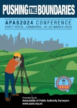
The 2024 annual conference of the Association of Public Authority Surveyors, NSW (APAS) will be held at the Hyatt Hotel, Canberra, from 18 to 20 March 2024. The theme of the conference will be ‘Pushing the Boundaries’.
The Call for Abstracts is now open, with the following deadlines set:
- Abstract submission deadline: Friday, 22 September 2023
- Draft paper deadline: Friday, 17 November 2023
- Final paper deadline: Friday, 19 January 2024


