Featuring Don Murray, Co-Founder and President at Safe Software. With over 30 years experience and a Masters Degree in Computer Science from Simon Fraser University, Don leads the direction of Safe and focuses his specialty on server and cloud-based solutions. He regularly travels around the world sharing his passion for making data integration accessible to everyone who needs it.
With only a limited number of seats available, don’t miss this opportunity to find out where it’s come from and what the future holds!
“Supported by SSSI and SIBA/GITA”

SSSI in conjunction with the Hunter Environmental Institute will present this webinar with three pre-eminent speakers:
Amy Steiger (Cardno)
Title: RPAS and thermal cameras for wildlife detection post-bushfire and coastal monitoring
Details: Amy has promoted the use of Remotely Piloted Aircraft Systems (RPAS) gaining experience with remote data capture to cover a range of coastal, environmental and land development applications.
RPAS thermal inspection capability was deployed this summer in wildlife detection post-bushfires.
Amy has also done volumetric surveys of beaches and flown isolated coastal cliff faces in NSW to capture high-resolution photography and derived photogrammetric models to identify geotechnical hazards and contribute to coastal monitoring.
Charity Mundava (WaterNSW)
Title: Remote Sensing in Water Management
Details: Charity will discuss the use of GIS and remote sensing to support water catchment management, feasibility and environmental studies for critical water infrastructure across the state and to support ongoing research into and management of river catchments. Charity will touch on the significance and spatial support for this in the recent NSW bushfires coordinating reservoir availability (in drought) and access for helicopter water drops and supporting bushfire fighting efforts.
Associate Professor In-Young Yeo (University of Newcastle)
Title: Remote sensing and GIS applications for water resources management
Details: Dr Yeo will explain how remote sensing can be used as a technique for assessing soil moisture using multi-source data fusion approaches, vegetation monitoring and water requirement with remote sensing and water balance approach.
She will explain the impacts of conservation management practices in agricultural catchments assessed using catchment model and remote sensing/GIS drawing on examples from Australian and American case studies
CPD Points
BOSSI CPD is 1 SP for this webinar.
Cost
As per details as follows
Contact
rom.nsw@sssi.org.au

The ITS Australia Summit 2022 in Brisbane will feature a strong industry program over three days driven by abstract submissions & invited keynote presentations, and will include technical tours & demonstrations, cutting edge industry exhibition, workshops, panel discussions, and an exciting social program.
As Australia’s leading transport technology event, Summit will demonstrate new insights and initiatives that will determine our path toward an accessible and automated future transport network.

The IGNSS Association’s biennial international GNSS conference will return to UNSW Sydney from 7 to 9 February, 2024, where it will celebrate the first half-century of GNSS and look ahead to the next 50 years.
IGNSS 2024 will bring together experts, policy makers and emerging leaders from across the globe to examine the latest advances, present cutting edge research and discuss policy, market development and infrastructure.
The conference will also showcase Australia and New Zealand’s Southern Positioning Augmentation Network (SouthPAN), along with developments by other countries across the Asia-Pacific.
Topics to be covered at the conference will include:
- Autonomy on land, air, sea and in space
- Aviation and avionics
- Cooperative Intelligent Transport Systems
- Machine guidance applications in agriculture, construction and mining
- Maritime applications
- Uncrewed aerial systems
- Space applications of PNT in Earth orbit and for lunar and Martian exploration
- Positioning infrastructure
- GNSS vulnerability, resilience and risk
- Interference detection and mitigation
- Policies and standards
- SBAS and other augmentations
- Datums and geodesy
- National and international GNSS developments
- Emerging application areas for GNSS
- Key industries and their reliance on GNSS
- The multi-GNSS era
- Cyber security in PNT applications and infrastructure
- Alternative PNT
- State of the art in PNT algorithms and software development
- GNSS aiding and sensor fusion
- Positioning in GNSS denied environments
- Development of GNSS receiver hardware and firmware
- Precise position using smartphones
The organisers are encouraging early career researchers and industry representatives to present their work. The abstract submission process will open soon — keep an eye on the IGNSS website for announcements.
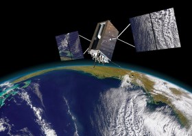
Image courtesy Lockheed-Martin

The Institute of Navigation’s (ION) Pacific PNT Conference is a global event dedicated to the cooperative development of positioning, navigation and timing technology and applications.
The conference attracts policy and technical leaders from Japan, Singapore, China, South Korea, Australia, the United States and many other countries, who meet to discuss policy updates, receive program status updates and exchange technical information.
The conference will cover a wide range of topics:
- GNSS policy/status
- Polynesian navigation
- Aircraft navigation and surveillance
- Algorithms and methods
- Alternative navigation and signals of opportunity
- Aviation applications of GNSS
- Challenging navigation problems
- Emerging PNT consumer applications
- GNSS-R and GNSS-RO for environmental monitoring
- High-precision GNSS correction and monitoring networks
- Inertial navigation technology and applications
- Interference and spectrum
- Ionosphere monitoring with GNSS
- Natural hazards detection and other remote sensing applications
- Time and frequency distribution
- Space navigation technologies
Substantial discounts are available for early registrations.


