WHERE TO NEXT? LOCATION, HOW WE DRIVE OUR DIGITAL FUTURE
The Locate Conference (Locate19) will explore how geospatial science is underpinning the rapid changes we are experiencing now in the fourth industrial revolution. From advanced data capture techniques, positioning, data analytics, artificial intelligence to strategy and policy, Locate 19 will explore how surveying and spatial science is a core enabling technology of the digital age . From health care, transport, consumer experience through to environment, energy, water, resources and smart cities, Locate19 will uncover the geospatial technologies driving our digital future, identify new insights and better outcomes for your organisation.
INVITATION TO ATTEND
On behalf of the Locate Conferences Australia it is our pleasure to invite you to join us at the Locate19 Conference, 8 – 10 April in Melbourne, Victoria.
Consistently named at the top of the world’s most liveable cities lists, Melbourne is Australia’s home of sport, art, live music, theatres, education and more. The MCEC Conference venue is on the banks of the Yarra River, in the heart of the city – the perfect location for the premier conference of the surveying and spatial industries in Australia and New Zealand.
With a theme of “Where to next? How geospatial science is driving our digital future” this conference will have an engaging approach that will bring together innovative global leaders who will share their ideas, knowledge, and experiences on a wide range of subjects. Every year Locate sets and shares the future direction of the industry, and brings speakers together across the government, private, non-profit and academic sectors.
You will have an opportunity to network with colleagues from all corners of the globe, have direct access to vendors and subject matter experts in the Interactive Zone, see the newest technology, and be introduced to the newest ideas in the spatial sector.
We look forward in seeing you in Melbourne.
GLENN COCKERTON & KATE WILLIAMS, CO-CONVENORS

Join us for the first session in our ‘Locate Connect’ online learning series! Hear from Scott Dewar, Director, Chris Hewett, Assistant Secretary GEOINT Capability and Development & Phil Shears, Director DEF799 Phase 2.
In this session from 1300 – 1400, the Australian Geospatial-Intelligence Organisation (AGO) will be launching the Defence Geospatial-Intelligence (GEOINT) Strategy, a document that addresses how the Defence GEOINT Community will transform to meet the future needs of the Australian Defence Force. The AGO Executive will also provide an update on their GEOINT projects and announce upcoming opportunities for industry and discuss how the COVID-19 pandemic has impacted the organisation.
Then from 1430 – 1545, AGO, along with Frontier SI will describe how The Analytics Lab Program (AGO Labs) fits into the bigger picture of AGO capability and summarise the outcomes of their 2019 activities. AGO Labs, coordinated through FrontierSI, is investigating a number of ways to better engage and work with industry. Specifically, the AGO is keen to attract a wider pool of companies and technologies to draw on for automated geospatial intelligence. The primary focus of this program is to address AGO capability challenges through a small number of short-term industry projects, with a focus on machine learning and analytics for producing automated imagery analysis, including automated object classification. AGO will announce a new 2020 program of challenges hoping to find innovative solutions through their partnership with FrontierSI.

The 15th International Conference on Spatial Information Theory, COSIT 2022, will be held in Kobe, Japan, 5 to 9 September, 2022. Established in 1993, the Conference on Spatial Information Theory (COSIT) is a biennial international conference series concerned with theoretical aspects of space and spatial information, aimed at advancing geographic information science and its emerging research frontiers.
The conference offers three (refereed) submission tracks with double-blind reviews: vision papers, full papers, and short papers. Embedded in the conference will also be an on-site mentoring program for doctoral students.
Contributions can cover a broad set of conference-relevant themes such as (but not limited to):
- activity-based models of spatial knowledge
- cognitive aspects of geographic information
- cognitive-behavioural geography, naive geography
- data-driven spatial information theory
- geo-ethics and geo-privacy
- events and processes in geographic space and time
- geographic information visualisation and geovisual analytics
- knowledge representation for space and time
- navigation and wayfinding of sentient beings and robots
- ontology of space and time
- place
- quality and interoperability of geographic information
- social and cultural organisation of space
- spatial and temporal language
- spatial aspects of social networks
- spatial decision support, impact of model design
- spatial (digital) humanities
- theory-driven spatial machine learning, artificial intelligence of space
- theories on volunteered geographic information
- theory and practice of spatial and temporal reasoning
- user interfaces, virtual spaces and collaborative spaces

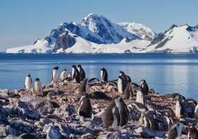
Since the establishment of Scott Base on Ross Island by the late Sir Edmund Hillary in 1957, surveyors have been appointed to assist scientists with survey related tasks on the ice.
This presentation by a panel of Antarctic surveyors promises to be educational, entertaining and informative, as they talk about their experiences on projects on the frozen continent over the last 35-plus years.
Image credit: ©stock.adobe.com/au/hrathke


