SDB Day 2019
The International Forum on Satellite-Derived Bathymetry 2019
Esteemed speakers and guests from hydrographic offices, marine industry, service providers and research institutes around the world will gather for Australia’s first SDB Day in May 2019.
Satellite Derived Bathymetry (SDB) is a method for providing high-resolution water depth data in shallow water environments. These waters are notoriously difficult and expensive to access. The method combines satellite imagery with advanced algorithms to provide affordable and accurate data, and all within a relatively quick turnaround time.
The forum addresses the urgent need for both users and producers of SDB to jointly discuss capabilities, standards, data integration and handling uncertainties in its application.

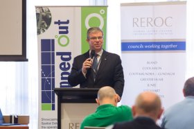
The latest in spatial data applications will be showcased at this year’s Mapped Out Conference to be held at the Rules Club in Wagga Wagga on Wednesday 2 & Thursday 3 March 2022.
Mapped Out will highlight the diversity of applications for spatial data, geographic information systems and their supporting technologies. Guest speakers with local and national experience will be showcasing the use of spatial data to enhance the operation and delivery of government services.
The Conference is a great opportunity for people working in regional NSW in both local government and the private sector to keep abreast of the latest technology and geographical information systems that can be utilised in their day to day work.

Unable to hold its scheduled 2021 NSW Regional Conference earlier in 2022, SSSI is now inviting the spatial community to join it for a special online seminar featuring some of the speakers from the original program, along with the announcement of the NSW winners of the 2021 Asia-Pacific Spatial Excellence Awards.
This seminar will focus on the importance, efficiency and innovation spatial data can provide in crisis management situations and will feature presentations on:
- Finding your Friendship Island amongst a sea of COVID restrictions — presented by Stella Blake-Kelly, Founder/Director, Cartisan
- Geospatial Intelligence: Providing real-time insights supporting NSW State Emergency Service’s emergency management response — presented by Melissa Daley, Manager, Geospatial Intelligence Systems, NSW State Emergency Service
- COVID-19 Near Me: Trials and tribulations — presented by Kenneth Tsang, Director, jxeeno

The 15th International Conference on Spatial Information Theory, COSIT 2022, will be held in Kobe, Japan, 5 to 9 September, 2022. Established in 1993, the Conference on Spatial Information Theory (COSIT) is a biennial international conference series concerned with theoretical aspects of space and spatial information, aimed at advancing geographic information science and its emerging research frontiers.
The conference offers three (refereed) submission tracks with double-blind reviews: vision papers, full papers, and short papers. Embedded in the conference will also be an on-site mentoring program for doctoral students.
Contributions can cover a broad set of conference-relevant themes such as (but not limited to):
- activity-based models of spatial knowledge
- cognitive aspects of geographic information
- cognitive-behavioural geography, naive geography
- data-driven spatial information theory
- geo-ethics and geo-privacy
- events and processes in geographic space and time
- geographic information visualisation and geovisual analytics
- knowledge representation for space and time
- navigation and wayfinding of sentient beings and robots
- ontology of space and time
- place
- quality and interoperability of geographic information
- social and cultural organisation of space
- spatial and temporal language
- spatial aspects of social networks
- spatial decision support, impact of model design
- spatial (digital) humanities
- theory-driven spatial machine learning, artificial intelligence of space
- theories on volunteered geographic information
- theory and practice of spatial and temporal reasoning
- user interfaces, virtual spaces and collaborative spaces

Hosted by the Riverina Eastern Regional Organisation of Councils and the Riverina Spatial Information Group, Mapped Out 2023 will bring together public- and private-sector professionals to learn about the latest geospatial developments.
Mapped Out will highlight the diversity of applications for spatial data, geographic information systems and their supporting technologies. Guest speakers with local and national experience will be showcasing the use of spatial data to enhance the operation and delivery of government services.
The Conference is a great opportunity for people working in regional NSW in both local government and the private sector to keep abreast of the latest technology and geographical information systems that can be utilised in their day-to-day work.

The Institute of Navigation’s (ION) Pacific PNT Conference is a global event dedicated to the cooperative development of positioning, navigation and timing technology and applications.
The conference attracts policy and technical leaders from Japan, Singapore, China, South Korea, Australia, the United States and many other countries, who meet to discuss policy updates, receive program status updates and exchange technical information.
The conference will cover a wide range of topics:
- GNSS policy/status
- Polynesian navigation
- Aircraft navigation and surveillance
- Algorithms and methods
- Alternative navigation and signals of opportunity
- Aviation applications of GNSS
- Challenging navigation problems
- Emerging PNT consumer applications
- GNSS-R and GNSS-RO for environmental monitoring
- High-precision GNSS correction and monitoring networks
- Inertial navigation technology and applications
- Interference and spectrum
- Ionosphere monitoring with GNSS
- Natural hazards detection and other remote sensing applications
- Time and frequency distribution
- Space navigation technologies
Substantial discounts are available for early registrations.

The 2024 edition of the International Conference on Geographical Information Systems Theory, Applications and Management (GISTAM 2024) aims to create a meeting point of researchers and practitioners that address new challenges in geo-spatial data sensing, observation, representation, processing, visualization, sharing and managing, in all aspects concerning both ICT as well as management information systems and knowledge-based systems.
The conference welcomes original papers of either practical or theoretical nature, presenting research or applications, of specialised or interdisciplinary nature, addressing any aspect of geographic information systems and technologies, such as:
- Data acquisition and processing
- Remote sensing
- Interaction with spatial-temporal information
- Spatial data mining
- Managing spatial data
- Modelling, representation and visualisation
- GIS and climate change
- Domain applications


