We are pleased to announce our Qld Conference Highlights Webinar Series, showcasing some of the most popular presentations from our 2019 Qld Surveying & Spatial Day, Central Group and Northern Group Conferences.
First up is Dale Atkinson, presenting Native Title and the role of Cadastral Surveyor.
There have been over 120 Native Title Determinations registered in Queensland alone. Complicated legal concepts, lengthy federal court judgements and cultural sensitivities have made this a very avoidable issue for the cadastral surveyor. This talk attempts to provide a basic understanding and argues that there is a vital role for cadastral surveyors to play in this process.
Dale is a cadastral surveyor that runs a small rural based practice in North Queensland. He has a keen interest in rural surveying and maintains a good relationship with many retired rural surveyors. Dale is currently the Chair of the Qld Land Surveying Commission Committee.
Don’t forget to check out our other webinars here.
Registration
By registering below, you receive access to the watch the webinar live OR if you can’t watch it live, you receive the link to the recording 24 hours after the event date. You can then watch the recording at your leisure.
BOSSI CPD
BOSSI CPD points have been assessed as below. The event code for BOSSI is: tbc
- 1.00 BOSSI Cadastral points for live viewing
- 1.00 BOSSI Cadastral points for viewing the recorded webinar if accompanied by a questionnaire with 80% pass mark (contact Katie for a copy)
- 0.5 BOSSI Cadastral CPD points for viewing of the recorded webinar with no questionnaire
Contact
Katie Le Miere
rom.qld@sssi.org.au

During GEO Week 2021, the Group on Earth Observations will present the multidisciplinary activities of the GEO Work Programme that address policy agendas involved in the UN Framework Convention on Climate Change (UNFCCC) COP26, the Convention on Biological Diversity (CBD) COP15, the UN Decade of Ocean Science for Sustainable Development and the UN Decade of Ecosystem Restoration.
The online event will include the GEO-17 plenary, plus anchor and side events. Time will be scheduled each day for virtual networking. On Monday, November 22, the 56th Executive Committee will be held as a closed meeting.
Of particular importance will be the anchor events: These are the main events designed by GEO week 2021 organisers to explain the multidisciplinary nature of GEO through the concept of nexus thinking. Working on multiple topics simultaneously is essential in today’s rapidly changing environmental and social conditions. For example, work in one area will have a knock-on effect or impact in another area, such as the water, energy and food nexus. These events are linked to the global policy agendas that underpin most of GEO’s work.
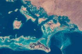
Image credit: NASA

The International Society for Photogrammetry and Remote Sensing (ISPRS) will hold its 2022 congress in Nice, France, in June 2022. The event will be hosted by the French Society for Photogrammetry and Remote Sensing.
A wide-ranging program has been put together, and it includes a host of leading speakers, such as Australia’s Professor Sisi Zlatanova from the University of South Wales. More than 1500 papers will be presented in the various scientific tracks and sessions over the week. In addition to these presentations, participants will also have the chance to interact and network face-to-face with the authors in poster sessions.
In order to help the registered participants to choose the sessions and the presentations to build their own program during the week, pre-recorded video presentations of the papers will made accessible before the beginning of the event through the digital platform of this event.
The Congress will have a strong technology track, with a large exhibition space that will gather the major players of the geospatial business. A geospatial prospective forum will also address hot topics of our community in order to draw recommendations.
The deadline for both full papers and abstracts is January 10, 2022.

The Committee of Experts on Global Geospatial Information Management (UN-GGIM) will convene the second United Nations World Geospatial Information Congress (UNWGIC) in Hyderabad, India from 10-14 October 2022.
Hosted by the Government of India through its Ministry of Science and Technology, the convening of the UNWGIC arises out of the mandate from the United Nations Economic and Social Council (ECOSOC) to the Committee of Experts to convene global forums to promote comprehensive dialogue on global geospatial information management with all relevant governments, international organisations and stakeholders.
With an overarching theme ‘Geo-Enabling the Global Village: No one should be left behind,’ the second UNWGIC will reflect the importance of integrated geospatial information to support sustainable development and the wellbeing of society, address environmental and climate challenges, embrace digital transformation and technological development, and catalyse vibrant economies.
The congress addresses the development and strengthening of integrated geospatial information management, its capacities and capabilities, and demonstrates the importance of international cooperation and coordination for building a human data and geography community, against the three pillars of sustainable development, for a shared future and a better world, leaving no one behind within an inclusive and equitable global society.
The UNWGIC will feature a high-level, plenary, special and parallel sessions. While the actual second UNWGIC program covers three days (11 – 13 October), the overall event will be a weeklong (10 – 14 October), and will include global and regional meetings, workshops and learning events, expert meetings and side events, including the eleventh plenary meeting of the Regional Committee of United Nations Global Geospatial Information Management for Asia and the Pacific (UN-GGIM-AP), as well as the annual meeting of the UN-GGIM Expanded Bureau.

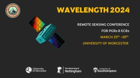
The Wavelength meeting was launched in 2013 for PhD students and early career researchers, addressing the demand for representation of new professionals as well as students from RSPSoc — the UK society for remote sensing and photogrammetry science.
Every year, Wavelength gathers participants from student and early career levels, as well as senior members and individuals within academia and business. The conference offers a setting to present student and EC work and meet new, like-minded contacts.
The 2024 conference will be run in a hybrid format, to accommodate those who can and those who cannot travel to Worcester.

The 4th International Symposium on Applied Geoinformatics (ISAG2024), which will take place at the Wroclaw University of Science and Technology, Wroclaw, Poland, on 9 and 10 May 2024. ISAG2024 is jointly organised by the Department of Geomatics Engineering, Yildiz Technical University, Istanbul, Türkiye, Wroclaw University of Science and Technology, Wroclaw, Poland and Technical University of Crete, Chania, Crete, Greece.
The aim of the 4th ISAG is to bring scientists, engineers and industry researchers together to exchange and share their experiences and research results and discuss the practical challenges encountered and the solutions adopted in geoinformatics.
Topics to be covered include recent advances in AI, satellite imagery, advanced remote sensing, photogrammetry, image processing, global navigation satellite systems, height systems, terrestrial laser scanning, GIS, smart cities and land management.


