Held on Sunday, 9th February, 2020, the SSSI National Bushfire Recovery Map-a-thon was a way for the national and international community to work together to map a total of 2,793,879 hectares affected by recent Australian bushfires with the focus being on burnt infrastructure. Join us for this Webinar to hear more about the initiative.
Speakers:
Dr Lesley Arnold (SSSI National Board Director) will give an overview of the Map-a-thon initiative and discuss overall logistics of planning; industry, government and NGO engagement; the challenges and overall execution of the event.
Nathan Eaton, Executive Director, NGIS Australia will give an overview of the technical set-up of this mammoth Map-a-thon and highlight some of the challenges and triumphs experienced.
This is a free event open to those who participated in the Map-a-thon or are involved in the surveying and spatial community.
Details about how to join the Webinar will be emailed to you prior to the event.
To read more about the SSSI National Bushfire Recovery Map-a-thon see the news item here

Speaker:
Rebecca Price is the Principal Policy Officer, Land Management Policy | Energy, Environment and Climate Change at DELWP.
Rebecca will be presenting on the update of the Marine and Coastal Policy that was recently released. Join in the questions and answers after the presentation.
If you are involved in sea level implications from beach erosion, storm surges, the tidal interface, land tenure etc, don’t miss this webinar!
Second speaker to be announced.
Cost
Member FREE | Non-member $45
Contact

During GEO Week 2021, the Group on Earth Observations will present the multidisciplinary activities of the GEO Work Programme that address policy agendas involved in the UN Framework Convention on Climate Change (UNFCCC) COP26, the Convention on Biological Diversity (CBD) COP15, the UN Decade of Ocean Science for Sustainable Development and the UN Decade of Ecosystem Restoration.
The online event will include the GEO-17 plenary, plus anchor and side events. Time will be scheduled each day for virtual networking. On Monday, November 22, the 56th Executive Committee will be held as a closed meeting.
Of particular importance will be the anchor events: These are the main events designed by GEO week 2021 organisers to explain the multidisciplinary nature of GEO through the concept of nexus thinking. Working on multiple topics simultaneously is essential in today’s rapidly changing environmental and social conditions. For example, work in one area will have a knock-on effect or impact in another area, such as the water, energy and food nexus. These events are linked to the global policy agendas that underpin most of GEO’s work.
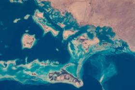
Image credit: NASA

Featuring a spotlight on crowd-sourced bathymetry, the Map the Gaps Symposium 2023 will bring people together to learn, share and contribute to ocean discovery.
Held on behalf of GEBCO, this event draws global experts in ocean technology, science and policy to discuss deep and coastal ocean exploration, offshore surveying technology, policy, diversity, equity and inclusion, the Nippon Foundation-GEBCO Seabed 2030 project and GEBCO alumni activities.
Participation is open to all, including industry professionals, explorers, authors, students, researchers, government representatives and emerging technologists. Participants can attend in person or online.

GeoBuiz Summit is an annual international conference focused on the geospatial industry, which encompasses a range of technologies and applications related to mapping, location-based services, and spatial data analysis.
The summit brings together industry leaders, government representatives, experts, and innovators to discuss the latest trends and innovations in geospatial technology and applications.
The conference covers a range of topics, including geospatial infrastructure, mapping and surveying, satellite imagery and remote sensing, location-based services, smart cities and urban planning, and much more. The GeoBuiz Summit aims to promote collaboration and knowledge-sharing within the geospatial industry and to showcase the latest developments in this exciting and rapidly evolving field.


